
Bailey Bach
Also known asBailey Bach Round Cairn and Cist · Baily Bach
DatedEst. 2900–800 BCE
Photo CHARLES GORDON CLARK · CC BY-SA 2.0Source file on Wikimedia Commons

Overview
About this site
What the sources say
Bailey Bach (auch Baily Bach) bei Baily Brith und Merthyr Cynog, östlich der Straße B4520 in Powys (Brecknockshire) in Wales ist ein zumindest teilweise natürlicher ovaler Tumulus mit Resten einer Steinkiste oder eines Kammergrabes (englisch chambered tomb), nördlich des Bannau-Brycheiniog-Nationalparks.
Der Deckstein misst etwa 2,9 × 1,45 m und ist 0,5 m dick. Er liegt schräg auf zwei quaderförmigen Tragsteinen von etwa 0,4 m Seitenlänge und dem Langhügel von etwa 42,0 × 14,0 m und bildet eine Kammer von etwa 1,5 × 1,0 m.
Article in GermanRead on Wikipedia2 min readCC BY-SA 4.0
Where it sits in time
The site's dated range, placed against world reference points.
The scale is logarithmic: each step to the left is about ten times older than the last.
The full article
Bailey Bach: the whole story
In briefSources for this section
- Wikipedia (German): Bailey BachCC BY-SA 4.0
Sources for this section
- Wikipedia (German): Bailey BachCC BY-SA 4.0
Bailey Bach, also called Baily Bach or Bailey Bach Round Cairn and Cist, is a cist near Baily Brith and Merthyr Cynog in Powys (Brecknockshire), Wales. It lies east of the B4520 road, north of Bannau-Brycheiniog National Park.
The monument is an at least partly natural, oval mound containing the remains of a stone cist or chambered tomb. Its capstone measures about 2,9 × 1,45 m and is 0,5 m thick. It rests at an angle on two roughly cuboid supporting stones, each about 0,4 m along a side.
The capstone and supporting stones form a chamber measuring about 1,5 × 1,0 m within a long mound of about 42,0 × 14,0 m. The surviving structure has also been described as a stone cist or chambered tomb, although the precise form of the burial place is not fully preserved.
The site is dated by typological estimate to 2900 BCE to 800 BCE. In Britain and Ireland, cists are generally small stone-built, coffin-like boxes used for the dead and often covered by a cairn or long barrow. Such burials may contain inhumations or cremations placed in a vessel.
No English Wikipedia article exists for it; the full text below is the German article "Bailey Bach", shown in the original language.
Summary in EnglishSources for this section
- Wikipedia (German): Bailey BachCC BY-SA 4.0
Sources for this section
- Wikipedia (German): Bailey BachCC BY-SA 4.0
Bailey Bach is a cist in Powys, United Kingdom. A typological estimate: 2900 BCE to 800 BCE. No English Wikipedia article exists for it; the full text below is the German article "Bailey Bach", shown in the original language.
How this page was madeSources for this section
- Wikipedia (German): Bailey BachCC BY-SA 4.0
Sources for this section
- Wikipedia (German): Bailey BachCC BY-SA 4.0
The summary at the top of this page was written by MiniMax-M3 (2026-11-08) from the cited Wikipedia article “Bailey Bach”, translated from German. The numbers in it were checked automatically against the source text. The rest of the page is the article itself, the structured records and computed distances.
Tradition and region
About this kind of monument
British and Irish cists
In Britain and Ireland a cist is a small stone-built coffin-like box used to hold the dead, and it is one of the commonest finds in prehistoric graves. A cist may once have been covered by a cairn or a long barrow, and several are sometimes found together in the same cairn or barrow. Ornaments found in excavated cists point to the wealth or prominence of the person buried. The centre of a round barrow, which in Britain was mostly built between 2200 and 1100 BCE, may hold a stone cist or a cut grave, and the burial may be an inhumation or a cremation placed in a vessel.
The Bell Beaker phenomenon, which reached Britain and Ireland in the late Neolithic, brought individual burials, often under tumuli and with weapons, in place of the collective burials of the earlier Neolithic. Cists of this period are therefore often single graves. The Food Vessel culture of the Early Bronze Age used slab cists, and some of their stones carry cup and ring marks.
Kilmartin Glen in Argyll is the richest area, with numerous cists among its prehistoric monuments, including a linear cemetery of five burial cairns that runs for more than three miles. Several of its cairns and many natural rocks are decorated with cup and ring marks. More than 800 ancient monuments lie within ten kilometres of the village, 150 of them prehistoric.
The Atlas's cists are dated by their position in a barrow, by the pottery or ornaments found with the burial, and by radiocarbon dating of surviving bone. Where none is known, it gives a broad Neolithic to Bronze Age range.
When visiting, look for the slabs set on edge around a pit, and for the cap stone that may have fallen aside.
Paraphrased from Wikipedia: Cist, Wikipedia: Round barrow, Wikipedia: Kilmartin Glen, Wikipedia: Bell Beaker culture · CC BY-SA 4.0
See it in 3D
An interpretive reconstruction of the monument, standing on the real ground at its exact point, under the sun for that place and season. Drag to look around it.
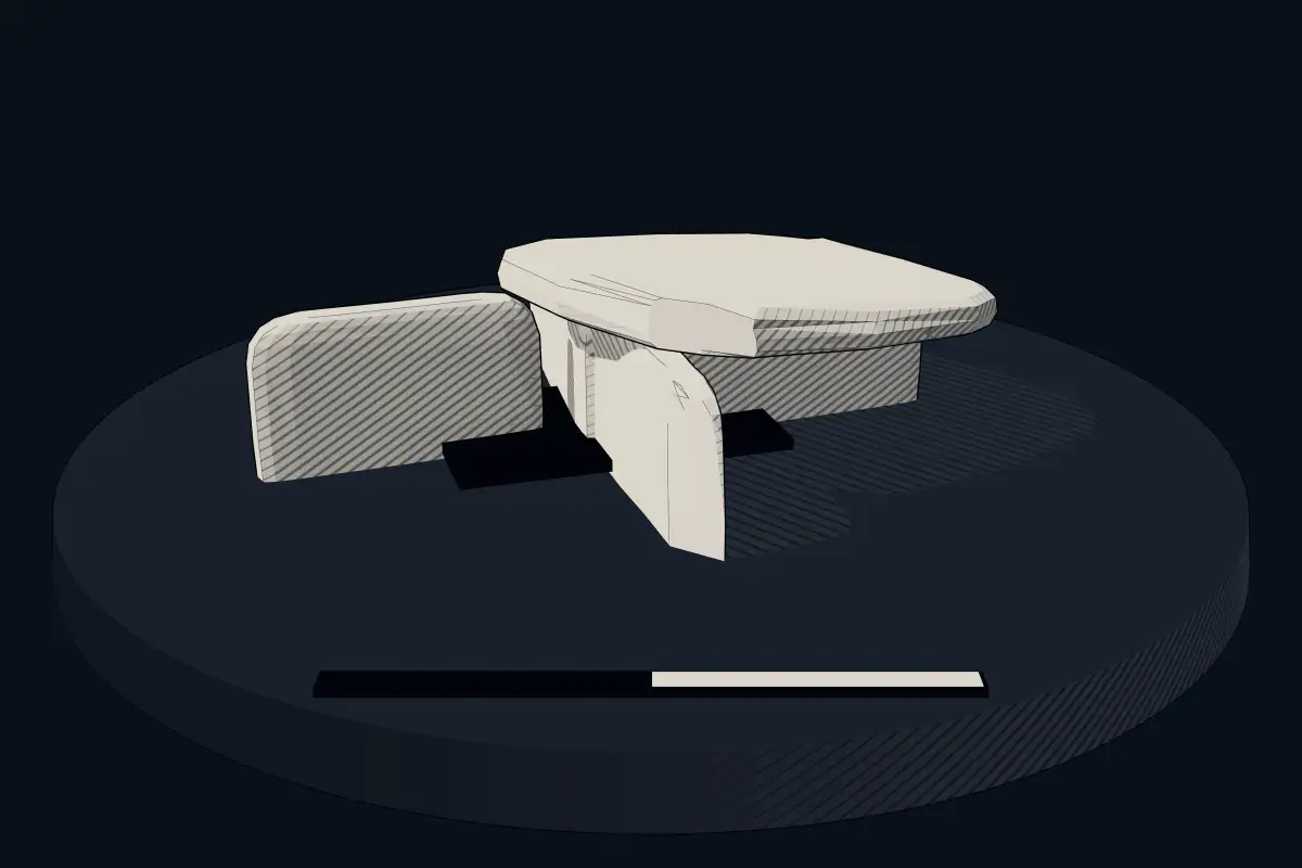
The reconstruction is ours, not a survey: it shows what a monument of this type looks like, at the size the record gives for this one.
Photographs
2 photographs, each with its author and licence
More photographs

Lore
Evidence & Lore
What the sources actually support — and, kept apart, what has been claimed.
What the evidence supports
Dates
Est. 2900–800 BCEHow this date was established: Type comparisonTypical range for cists in United Kingdom; this site has not been dated itself. British barrows of many types were in use from the late Neolithic until the end of the Bronze Age (2900-800 BC) and many contain a stone cist.Source for this date
Where it stands
United Kingdom
The pin marks the monument itself — its exact point.
- Coordinates
- 52°02′36″ N, 3°24′54″ WFor a GPS or map app: 52.04333, -3.41508
Access is as our sources describe it; we have not visited the site to check.
Nearby
The closest sites in the Atlas, by straight line.
- Megalithic mound (tumulus with integral stones)Cefn Clawdd, Cairn III4000–800 BCE
- Megalithic mound (tumulus with integral stones)Cornelau Uchaf, Clearance Cairn XII4000–800 BCE
- Megalithic mound (tumulus with integral stones)Cornelau Uchaf, Clearance Cairn XI4000–800 BCE
- Megalithic mound (tumulus with integral stones)Cornelau Uchaf, Clearance Cairn X4000–800 BCE
- Megalithic mound (tumulus with integral stones)Cornelau Uchaf, Clearance Cairn VIII4000–800 BCE
- Megalithic mound (tumulus with integral stones)Cornelau Uchaf, Clearance Cairn IX4000–800 BCE
- Megalithic mound (tumulus with integral stones)Cornelau Uchaf, Clearance Cairn IV4000–800 BCE
- Megalithic mound (tumulus with integral stones)Cornelau Uchaf, Clearance Cairn VII4000–800 BCE
Sources
Every record behind this page, with the link it came from.
2 sources behind this page
- 01Wikidata Q27698901wikidata.org
- 02Source for this dateen.wikipedia.org
Image files
Report a correctionWrong date, name, photograph or source? Tell us and it will be put right.
Around this place
The ten nearest sites, by compass
- Cefn Clawdd, Cairn III0.6 km N
- Cornelau Uchaf, Clearance Cairn XII0.9 km N
- Cornelau Uchaf, Clearance Cairn XI1.0 km N
- Cornelau Uchaf, Clearance Cairn X1.0 km N
- Cornelau Uchaf, Clearance Cairn VIII1.0 km N
- Cornelau Uchaf, Clearance Cairn IX1.0 km N
- Cornelau Uchaf, Clearance Cairn IV1.0 km N
- Cornelau Uchaf, Clearance Cairn VII1.0 km N
- Cornelau Uchaf, Clearance Cairn I1.1 km N
- Cornelau Uchaf, Clearance Cairn II1.1 km N
Credit
Text, licence and sources
Text from the Wikipedia article "Bailey Bach" (German), licensed CC BY-SA 4.0; authors are listed in the page history. Reused under CC BY-SA 4.0. Read on Wikipedia · Edit history and authors
- Wikipedia (German): Bailey BachCC BY-SA 4.0
- Wikidata Q27698901CC0