
pierres jumelles de Cambrai
DatedEst. 2800–1800 BCE
Photo Camster · CC BY-SA 3.0Source file on Wikimedia Commons

Overview
About this site
Overview
The Pierres Jumelles are a group of two menhirs at Cambrai, in the département of Nord, France. The catalogue gives a typological estimate of 2800 to 1800 BCE. The stones are about 4 metres high and are classified as historical monuments by the list of 1889.
Excavations in 1735, 1784 and 1805 found no trace of any monument around them and gave no indication of their origin.
Read on Wikipedia2 min readCC BY-SA 4.0
Where it sits in time
The site's dated range, placed against world reference points.
The scale is logarithmic: each step to the left is about ten times older than the last.
Article
pierres jumelles de Cambrai
DescriptionSources for this section
- Wikipedia (French): Pierres Jumelles (Cambrai)CC BY-SA 4.0
Sources for this section
- Wikipedia (French): Pierres Jumelles (Cambrai)CC BY-SA 4.0
Two small blocks are visible on the lawn, 3.60 m apart. When exposed in 1805 the stones were found to be about 4 metres high, 1.33 metres wide and 90 centimetres thick. They rest on limestone rocks stronger than those around them.
In 1735 the vicar general of the diocese, the abbé de Carondelet, had excavations carried out on the site.
ExcavationsSources for this section
- Wikipedia (French): Pierres Jumelles (Cambrai)CC BY-SA 4.0
Sources for this section
- Wikipedia (French): Pierres Jumelles (Cambrai)CC BY-SA 4.0
The stones formerly stood at the edge of an old Roman road. They are mentioned as early as 1396 in an account of the grands chartiers of Cambrai. In 1735 the vicar general of the diocese, the abbé de Carondelet, had excavations carried out on the site. Excavations made in 1784 were judged insufficient, and at the instigation of the Société d'émulation de Cambrai the town hall had new excavations made on 22 prairial an 13 (11 June 1805). The stones were laid bare. No rough sandstone of this kind occurs nearby, and the stones must have been brought from at least 15 kilometres away. No trace of masonry was found, and deep excavations in different directions revealed no sign of a monument on the site. They gave no indication of the origin of the stones.
FolkloreSources for this section
- Wikipedia (French): Pierres Jumelles (Cambrai)CC BY-SA 4.0
Sources for this section
- Wikipedia (French): Pierres Jumelles (Cambrai)CC BY-SA 4.0
According to legend, an ancient monument was erected on the site, either in honour of Mercury or in honour of the proconsul Canusius. A further legend holds that two young Gauls, in love with the same druidess, killed each other in a fight, and that their bodies, fallen on the spot, were turned to stone.
ContextSources for this section
- Wikipedia (French): Pierres Jumelles (Cambrai)CC BY-SA 4.0
Sources for this section
- Wikipedia (French): Pierres Jumelles (Cambrai)CC BY-SA 4.0
A menhir is a large upright stone placed by humans. The word comes from the Breton maen and hir, meaning long stone. Menhirs are most numerous in Western Europe, with about 1,200 in north-western France alone.
Tradition and region
About this kind of monument
Breton and French menhirs
A menhir is a large upright stone placed by humans. The word comes from the Breton maen and hir, "long stone", and entered archaeology through French antiquarians in the eighteenth and nineteenth centuries; in modern Breton the word for such a stone is peulvan. Menhirs are most numerous in Western Europe, with about 1,200 in north-western France alone, and Brittany stands out for both the density of monuments and the variety of types.
The largest known menhir is the Grand Menhir Brisé at Locmariaquer. It once stood nearly 20.6 metres high, and now lies fractured in four pieces; whole, it would have weighed some 330 tonnes. Stones in the Carnac area were hewn from local granite by the pre-Celtic people of Brittany. At Carnac more than 3,000 prehistoric standing stones form the largest such collection in the world, arranged in groups of alignments that stretch for four kilometres. The stones were erected at some point in the Neolithic, probably around 3300 BCE, with some perhaps as early as 4500 BCE. Elsewhere, the Cham des Bondons in the Cévennes is the second largest concentration in France, and a menhir 4.5 metres tall stands against Le Mans Cathedral, moved there in 1778 when its dolmen was destroyed.
Dating a menhir is difficult, because standing stones are usually hard to date and were put up in many different periods.
Folklore: a Christian legend held that the stones of Carnac were pagan soldiers who had pursued Pope Cornelius and were turned to stone by him. Modern beliefs link the stones with Roman and Christian occupation, even though they date from 4500 to 3300 BCE.
When visiting, look at how the stones taper towards the top and at how the alignments run across the slope.
Paraphrased from Wikipedia: Menhir, Wikipedia: Carnac stones, Wikipedia: Locmariaquer megaliths, Wikipedia: List of menhirs · CC BY-SA 4.0
From the article
Dated moments in the story
- 1396
Elles sont mentionnées dès 1396 dans un compte rendu des grands chartiers de Cambrai.
Source - 1735
En 1735, le vicaire général du diocèse, l'abbé de Carondelet, fit opérer des fouilles sur le site.
Source - 1784
Les fouilles faites en 1784 ont été estimées insuffisantes et à l'instigation de la Société d'émulation de Cambrai, la mairie a fait procéder à de nouvelles fouilles le 22 prairial an 13 (11 juin 1805).
Source - 1889
Les menhirs sont classés au titre des monuments historiques par la liste de 1889.
Source - 1896
Quarré-Reybourbon, Les Monuments mégalithiques dans les départements du Nord et du Pas-de-Calais, Tournai, 1896, 14 p. (lire en ligne), p.
Source
See it in 3D
An interpretive reconstruction of the monument, standing on the real ground at its exact point, under the sun for that place and season. Drag to look around it.
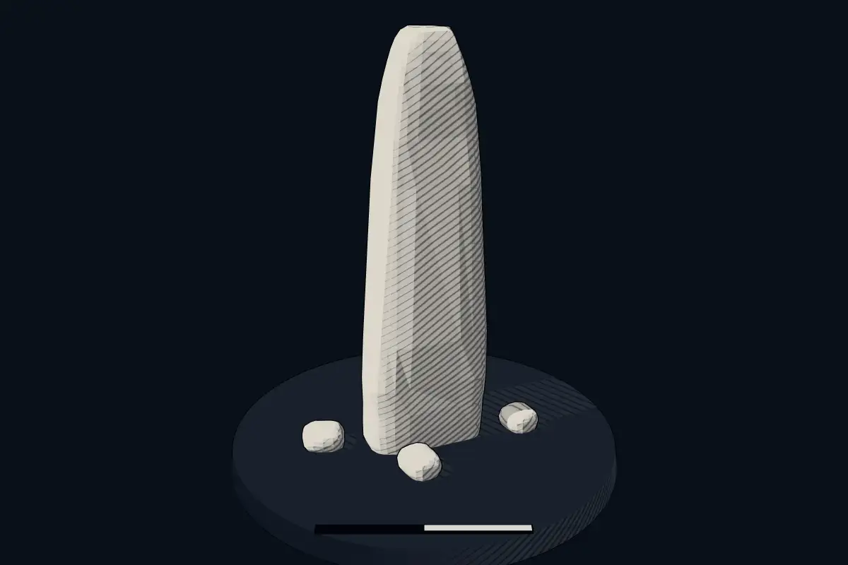
The reconstruction is ours, not a survey: it shows what a monument of this type looks like, at the size the record gives for this one.
Photographs
1 photograph, each with its author and licence
Lore
Evidence & Lore
What the sources actually support — and, kept apart, what has been claimed.
What the evidence supports
Dates
Est. 2800–1800 BCEHow this date was established: Type comparisonTypical range for menhirs in France; this site has not been dated itself. Standing stones are associated with the Beaker people of the European late Neolithic and early Bronze Age c. 2800-1800 BC.Source for this date
Where it stands
France
The pin marks the monument itself — its exact point.
- Coordinates
- 50°10′46″ N, 3°14′41″ EFor a GPS or map app: 50.17950, 3.24480
Access is as our sources describe it; we have not visited the site to check.
Nearby
The closest sites in the Atlas, by straight line.
 Pierre qui Pousse2800–1800 BCE
 Gros Caillou2800–1800 BCE
Photo: The original uploader was Pir6mon at French Wikipedia . · CC BY-SA 3.0
- Menhir (standing stone)menhir d'Oisy-le-Verger2800–1800 BCE
- Menhir (standing stone)Le Gros Caillou (Oisy-le-Verger)2800–1800 BCE
 pierre levée de Clary2800–1800 BCE
 dolmen du Bois4000–3000 BCE
- dolmen du Bois4000–3000 BCE
 Pierre du Diable2800–1800 BCE


Sources
Every record behind this page, with the link it came from.
2 sources behind this page
- 01Wikidata Q22960648wikidata.org
- 02Source for this dateen.wikipedia.org
Image files
Report a correctionWrong date, name, photograph or source? Tell us and it will be put right.
Lore, kept apart
Legends and claims
These are stories and claims reported by the sources. They are not evidence, and they never stand in for the dating above.
- Tradition
Selon la légende, deux jeunes Gaulois, amoureux de la même druidesse, s'entretuèrent dans un combat et leurs corps tombés sur place furent transformés en pierre.
Source - Tradition
Les pierres se dressaient au bord d'une ancienne voie romaine.
Les pierres se dressaient au bord d'une ancienne voie romaine. Elles sont mentionnées dès 1396 dans un compte rendu des grands chartiers de Cambrai. En 1735, le vicaire général du diocèse, l'abbé de Carondelet, fit opérer des fouilles sur le site. Selon la légende, un ancien monument a été érigé sur le site, soit en l'honneur de Mercure, soit en l'honneur du proconsul Canusius. Les fouilles faites en 1784 ont été estimées insuffisantes et à l'instigation de la Société d'émulation de Cambrai, la mairie a fait procéder à de nouvelles fouilles le 22 prairial an 13 (11 juin 1805). Les pierres jumelles ont été mises à nu. Elles ont environ 4 mètres de hauteur, 1,33 mètre de largeur et 90 centimètres d'épaisseur. Il n'existe pas de telles pierres en grès brut à proximité, elles ont dû y être amenées de 15 kilomètres au moins. Les pierres sont posées sur des roches calcaires plus fortes que celles qui les environnent. Aucun vestige de maçonnerie n'a été décelé. Les fouilles entreprises en profondeur et dans différentes directions n'ont pas permis de découvrir une quelconque trace d'un monument sur ce terrain. Elles n'ont pas fourni d'indication sur l'origine des pierres jumelles. Les menhirs sont classés au titre des monuments historiques par la liste de 1889.
Source
Around this place
The ten nearest sites, by compass
Credit
Text, licence and sources
Adapted from the Wikipedia article "Pierres Jumelles (Cambrai)" (French), licensed CC BY-SA 4.0; authors are listed in the page history. Reused under CC BY-SA 4.0. Read on Wikipedia · Edit history and authors