.JPG/1920px-Notre-Dame_de_Lorette_-_Le_Quillio_-_C%C3%B4tes_d'Armor_(d%C3%A9tail).JPG 1920w)
Cromlech de Lorette
DatedEst. 3300–2500 BCE
Photo Renardeau · CC BY-SA 3.0Source file on Wikimedia Commons

Overview
About this site
Overview
The Lorette burial mound (tertre tumulaire de Lorette), wrongly called the cromlech of Notre-Dame de Lorette, stands at the place called Lorette in the commune of Le Quillio, in the department of Côtes-d'Armor, Brittany, France. It is a rectangular mound edged with slabs and has been a classified historical monument since 29 March 1926.
Read on Wikipedia2 min readCC BY-SA 4.0
Where it sits in time
The site's dated range, placed against world reference points.
The scale is logarithmic: each step to the left is about ten times older than the last.
Article
Cromlech de Lorette
Its long sides are formed of slabs, generally touching one another and leaning outwards: sixteen quartz-rich slabs on the north side and eleven sandstone slabs on the south side.
DescriptionSources for this section
- Wikipedia (French): Tertre tumulaire de LoretteCC BY-SA 4.0
Sources for this section
- Wikipedia (French): Tertre tumulaire de LoretteCC BY-SA 4.0
The mound is rectangular, 20 m long and 7 m wide. Its long sides are formed of slabs, generally touching one another and leaning outwards: sixteen quartz-rich slabs on the north side and eleven sandstone slabs on the south side. The northern blocks are rather stocky and low, while those on the south side are much taller. The corner slabs have fallen backwards, and those at the north-west and south-west corners are broken.
An indicator menhir, now fallen and 2 m long, lies on the axis of the monument, 3 m to the west.
ExcavationsSources for this section
- Wikipedia (French): Tertre tumulaire de LoretteCC BY-SA 4.0
Sources for this section
- Wikipedia (French): Tertre tumulaire de LoretteCC BY-SA 4.0
The site was excavated in October 1958. The acidity of the soil did not allow any bones to survive, and the funerary goods recovered were themselves very few. The pottery is limited to fragments of undecorated Chasséen ware, fairly fine, hard and reddish; one slightly thicker sherd shows the beginning of a flat, slightly flared base. The stone tools consist of one tiny flint flake and tools of lustrous sandstone: 3 arrowheads with a transverse cutting edge and 2 blades.
The excavation noted several similarities with the burial mound of La Croix Saint-Pierre: a high site that is unsuitable for agriculture, an indicator menhir, a burial area concentrated in the eastern third or quarter of the mound, and poor grave goods.
ConservationSources for this section
- Wikipedia (French): Tertre tumulaire de LoretteCC BY-SA 4.0
Sources for this section
- Wikipedia (French): Tertre tumulaire de LoretteCC BY-SA 4.0
The monument has been a classified historical monument since 29 March 1926.
Tradition and region
About this kind of monument
Iberian and French cromlechs
In French, Spanish and many other languages a cromlech is a stone circle. In the Pyrenees, and especially in the Basque lands, the commonest stone circles are small burial monuments of the Iron Age. About 851 of these funerary cromlechs are documented in the Pyrenean region. Their diameters are 3 to 7 metres, with a burial in the middle, and the dead were not cremated inside the circle but at a nearby place, with only a handful of ashes carried to the monument. Burial customs changed over time, with a clear dominance of cremation in the Iron Age, and the ashes were placed in stone circles, mounds, caves, cists or urn fields.
The Alentejo in Portugal has much older circles. The Almendres Cromlech, near Évora, is the largest group of structured menhirs on the Iberian Peninsula, one of the largest in Europe. About 95 granite monoliths stand in small groups. The older Early Neolithic stones form two or three concentric circles of smaller monoliths in the west, the Middle Neolithic ones form two irregular ellipses with large menhirs, and in the Late Neolithic the earlier work was modified into a site for ritual. Many stones were found where they had fallen and were re-erected by Mário Varela Gomes. The site was rediscovered in 1966.
The dates are very different, from the Neolithic in Portugal to the Iron Age in the Pyrenees, so the single word cromlech hides several traditions.
When visiting, look for the entrance gap or axis of a circle, for the stones' differing heights, and for the position of the monument in relation to the sunrise.
Paraphrased from Wikipedia: Cromlech, Wikipedia: Almendres Cromlech, Wikipedia: Basque prehistory, Wikipedia: Portela de Mogos Cromlech, Wikipedia: Carnac stones · CC BY-SA 4.0
From the article
Dated moments in the story
- 1926
Le monument fait l’objet d’un classement au titre des monuments historiques depuis le 29 mars 1926.
Source - 1958
Le site a été fouillé en octobre 1958. L'acidité du sol n'a pas permis la conservation d'éventuels ossements.
Source - 2005
22-28 (lire en ligne) Loïc Langouët, Les mégalithes de l'arrondissement de Saint-Brieuc, Institut Culturel de Bretagne, 2005, 89 p.
Source
See it in 3D
An interpretive reconstruction of the monument, standing on the real ground at its exact point, under the sun for that place and season. Drag to look around it.
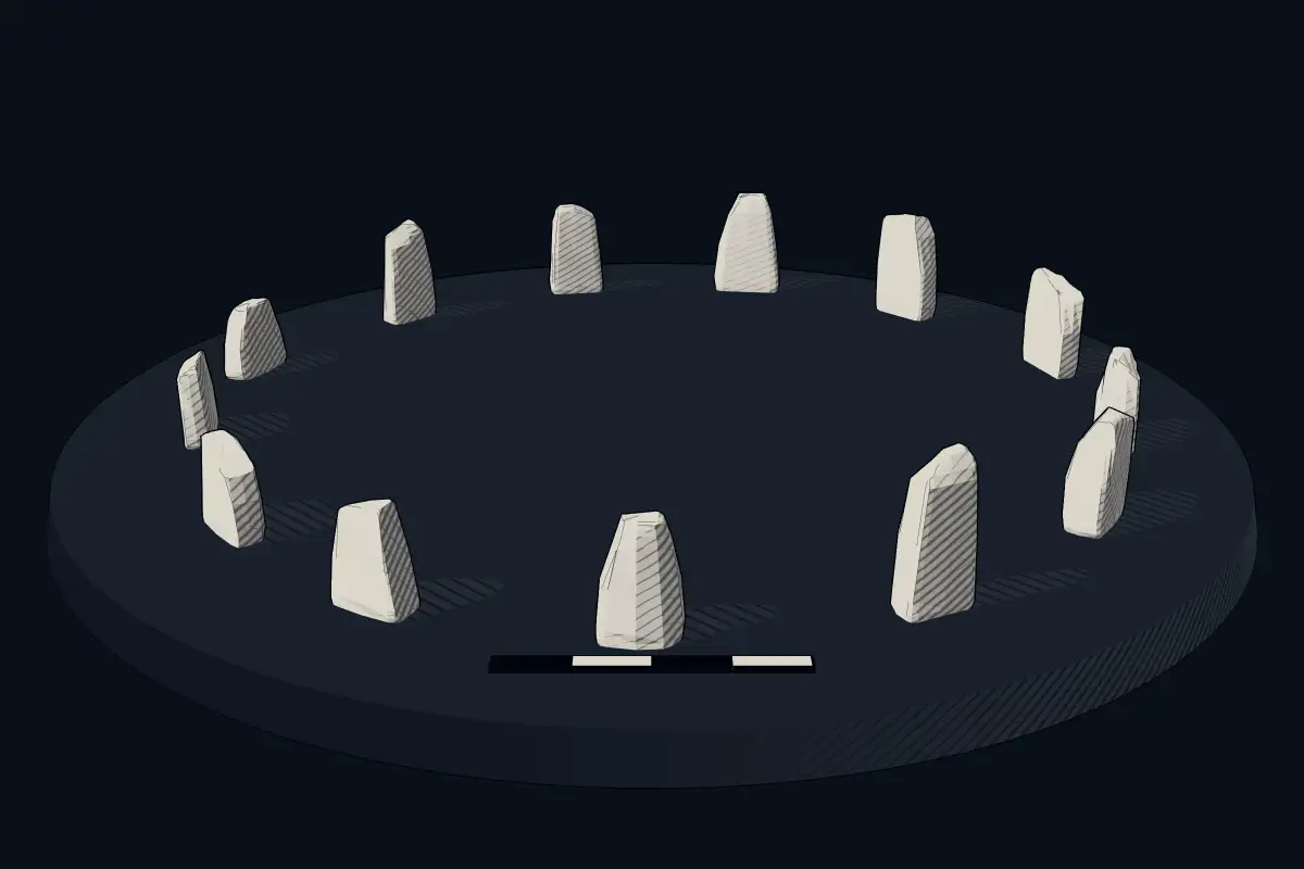
The reconstruction is ours, not a survey: it shows what a monument of this type looks like, at the size the record gives for this one.
Photographs
1 photograph, each with its author and licence
Lore
Evidence & Lore
What the sources actually support — and, kept apart, what has been claimed.
What the evidence supports
Dates
Est. 3300–2500 BCEHow this date was established: Type comparisonTypical range for stone circles in France; this site has not been dated itself. Stone circles are typical of Brittany and most were built between 3300 and 2500 BC.Source for this date
Where it stands
France
The pin marks the monument itself — its exact point.
- Coordinates
- 48°14′34″ N, 2°54′28″ WFor a GPS or map app: 48.24270, -2.90766
Access is as our sources describe it; we have not visited the site to check.
Nearby
The closest sites in the Atlas, by straight line.
 Menhir de Callac2800–1800 BCE
- Menhir (standing stone)menhirs de Caurel2800–1800 BCE
 Dolmen de Corn-er-Houët4000–3000 BCE
 Allée couverte de Coët Correc4500–3300 BCE
 sépulture mégalithique de Bod-er-Mohed4500–3300 BCE
- MegalithBugul er Hoët3470–2760 BCE
 Liscuis gallery graves4500–3300 BCE
 Menhir de Bodquelen2800–1800 BCE


Sources
Every record behind this page, with the link it came from.
2 sources behind this page
- 01Wikidata Q3003705wikidata.org
- 02Source for this dateen.wikipedia.org
Image files
Report a correctionWrong date, name, photograph or source? Tell us and it will be put right.
Around this place
The ten nearest sites, by compass
- Menhir de Callac4.3 km W
- menhirs de Caurel7.2 km W
- Dolmen de Corn-er-Houët7.7 km W
- Allée couverte de Coët Correc8.5 km W
- sépulture mégalithique de Bod-er-Mohed15 km SW
- Bugul er Hoët15 km SW
- Liscuis gallery graves17 km W
- Menhir de Bodquelen17 km NW
- Menhir de la Roche-Longue à Quintin17 km N
- Menhir de Goresto à Canihuel17 km NW
Credit
Text, licence and sources
Adapted from the Wikipedia article "Tertre tumulaire de Lorette" (French), licensed CC BY-SA 4.0; authors are listed in the page history. Reused under CC BY-SA 4.0. Read on Wikipedia · Edit history and authors