
Alignements du Bois de Fourgon
DatedEst. 3300–2500 BCE
Photo Stephanbloch · Public domainSource file on Wikimedia Commons

Overview
About this site
Overview
The Alignements du Bois de Fourgon are a group of four megalithic alignments (numbered G1, G2, G2 bis and G3) at Avrillé, in the département of Vendée, France. The catalogue record gives a typological estimate of 3300 to 2500 BCE, and the site lies within a megalithic complex that also includes a dolmen, a megalithic chest, two megalithic quarries and several tumuli.
Excavations by Gérard Benéteau and his team in the 1990s, and again in 2009-2010, revealed further menhirs and alignments. Radiocarbon dates and pottery place the activity in the Middle and Late Neolithic.
Read on Wikipedia4 min readCC BY-SA 4.0
Where it sits in time
The site's dated range, placed against world reference points.
The scale is logarithmic: each step to the left is about ten times older than the last.
Article
Alignements du Bois de Fourgon
The complex lies in an enclosed wood, itself part of a former closed estate formed around a Renaissance château, the château de la Guignardière, since the end of the sixteenth century.
SettingSources for this section
Sources for this section
The complex lies in an enclosed wood, itself part of a former closed estate formed around a Renaissance château, the château de la Guignardière, since the end of the sixteenth century. This setting has probably ensured the good preservation of the megalithic complex.
The site comprises four megalithic alignments oriented north-south, a dolmen, a megalithic chest, two megalithic quarries and several tumuli. One of these is an oval tumulus oriented east-west and surrounded by a ditch, about 12 m long by 6 m wide, situated between groups G1 and G2. The main group stands at the top of the plateau, at an altitude of between 38 m and 47 m.
DescriptionSources for this section
Sources for this section
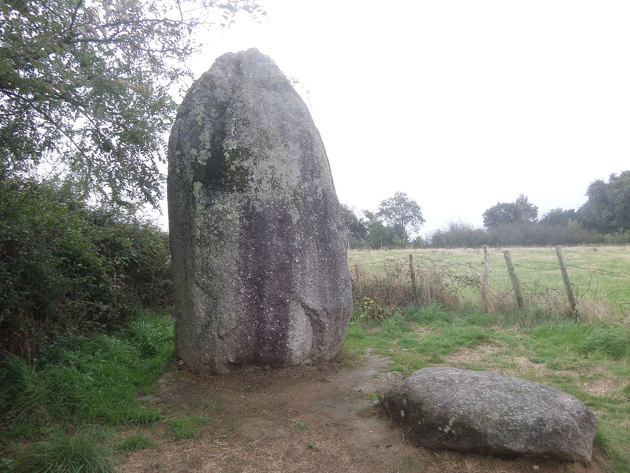
Alignment G1 is the easternmost. Before its excavation in 1996 it consisted of a large menhir 6 m high, adjoined by a monolith 2,40 m high and three partly buried blocks, the whole extending over 9 m. After excavation only two overturned blocks in the north were recognised as additional menhirs (numbered 1 and 2). They had been erected in shallow wedging pits 15 cm to 20 cm deep, the wedging stones having been reinforced with a kind of mortar. Menhir no 2 was carefully dressed by bush-hammering to give it an anthropomorphic form. Both menhirs were re-erected after the excavation. A third, triangular block found lying half-way between menhirs 1 and 2 and menhirs 3 and 4 had no corresponding wedging pit. It was therefore not recognised as a menhir but as the remains of an earlier construction, about 2 m by 1 m, which was destroyed when the alignment was built.
Alignment G2 lies 63 m south-west of G1 and consists of five menhirs, four of which were visible before excavation. Pit structures and assembly lines found during the excavation of 1994 were interpreted as traces of the operations by which the large menhir no 3 was raised. The alignment was dismantled in recent times, probably by quarrymen: menhir no 5 was cut up, the visible part corresponding to its top, and menhir no 2 was fractured into three parts, one of which has disappeared. The dismantling may date from the building of the château de la Guignardière, as indicated by fragments of iron tools and a liard of Henri IV found during the excavations. According to Gérard Benéteau, four of the five menhirs have anthropomorphic characteristics. The granite menhirs were regularly dressed by bush-hammering, whereas the sandstone menhir received a coarser treatment. Petrographic study confirmed the local origin of the granite slabs, but the nearest sandstone source lies 2,5 km further south. The wedging stones are of varied kinds (quartz, aplite, limestone) and come from outcrops or from the beds of nearby streams.
Alignment G2 bis lies about 45 m south-west of G2. It was discovered only during the excavation campaign of 2009-2010 and consists of three small menhirs, one of which has anthropomorphic characteristics.
Alignment G3 is the westernmost. It consists of five granite blocks, the tallest 3 m high and the smallest 0,60 m. This alignment has not been excavated.
FindsSources for this section
Sources for this section
Stone objects were found over the whole area occupied by the menhirs and were probably lost during the work of erecting the alignments. They are mainly of flint of coastal origin, but also of more distant origin (Montbert quartzite and banded flint). Alignment G1 yielded two scrapers, a roughout for an arrowhead, a flint flake and the butt of a flint axe. The excavation of G2 produced a few retouched flakes, a knife, a side-scraper and two scrapers.
The pottery sherds collected at G1 come from carefully made vessels of brown or dark beige paste with smoothed walls. The pottery collected around G2 includes incised decoration on a brown paste and may correspond to the Middle or Late Neolithic. At the foot of a menhir of alignment G2 bis, a complete round-bottomed vase, a polished fibrolite chisel and a notched knife were found. The wedging pit of menhir no 1 contained three other vases characteristic of the Atlantic Middle Neolithic.
DatingSources for this section
Sources for this section
Charcoal found in the pit of menhir no 2 of alignment G2 was radiocarbon dated to 4490 +/- 70 ans BP, that is, approximately between 3 356 and 2 926 BCE, which would confirm the Late Neolithic period indicated by the pottery. The Middle Neolithic attribution of the vases in the wedging pit of menhir no 1 was supported by a radiocarbon date from the remains of a hearth found in the same pit, indicating a period between 4 708 and 4 498 BCE.
ConservationSources for this section
Sources for this section
Three menhirs of alignment G2 were classified as historical monuments by the list of 1889.
Tradition and region
About this kind of monument
Carnac and the Breton alignments
The Carnac stones, near the south coast of Brittany, are an exceptionally dense collection of megalithic sites, with alignments, dolmens, tumuli and single menhirs. More than 3,000 prehistoric standing stones were hewn from local granite and erected by the pre-Celtic people of Brittany, and form the largest such collection in the world. The stones were erected at some stage in the Neolithic, probably around 3300 BCE, though some may date from as early as 4500 BCE. Most lie in the municipality of Carnac, with some to the east in La Trinité-sur-Mer, and others at Locmariaquer, Arzon and on islands in the Gulf of Morbihan.
There are three major groups of rows, called Ménec, Kermario and Kerlescan. They may once have formed a single group, split up as stones were taken for other purposes. Together they trace a contour line about 20 metres above sea level, and the stones are arranged in rows that stretch across four kilometres.
Three exceptionally large burial mounds of the mid-fifth millennium BCE, the "Carnacéen tumuli" of Saint-Michel, Tumiac and Mané-er-Hroëk, each hold a megalithic chamber with a single individual and numerous large polished stone axes. On the island of Gavrinis a passage tomb built around 4200 to 4000 BCE, one of the world's oldest surviving buildings, has stones covered in megalithic art.
Folklore: a Christian legend held that the stones were pagan soldiers pursuing Pope Cornelius, whom he turned to stone. Modern beliefs associate the rows with Roman and Christian occupation, although the stones date from 4500 to 3300 BCE.
Dating comes from radiocarbon dates on the tombs and from the stratigraphy at the foot of the stones.
When visiting, walk the alignments at Ménec and Kermario, and notice the stones growing taller towards one end.
Paraphrased from Wikipedia: Carnac stones, Wikipedia: Menhir, Wikipedia: Locmariaquer megaliths, Wikipedia: Gavrinis · CC BY-SA 4.0
From the article
Dated moments in the story
- 708 CE
Cette expertise a été corroborée par la datation au C14 des vestiges d'un foyer retrouvé dans la même fosse indiquant une période comprise entre 4 708 et 4 498 avant J.-C..
Source - 926 CE
Des charbons de bois retrouvés dans la fosse du menhir no 2 de l'alignement G2 ont pu être datés au C14 de 4490 +/- 70 ans BP, soit environ entre 3 356 et 2 926 avant J.-C., ce qui confirmerait la période du Néolithique récent indiquée par la céramique.
Source - 978 CE
(ISBN 978-2-9542549-0-6) Nicolas Jolin, Une maison pour l'éternité, le mégalithisme en Vendée, Saint-Géréon, Société Nantaise de Préhistoire, coll. « Bulletin Études » (no 28-2016), 2016, 87 p.
Source - 1889
Trois menhirs de l'alignement G2 sont classés au titre des monuments historiques par la liste de 1889. Le site du Bois de Fourgon a été fouillé par Gérard Benéteau et son équipe au cours des années 1990. Cette campagne de fouille a notamment permis de découvrir de nouveaux menhirs et de nouveaux alignements.
Source - 1996
46° 28′ 12″ N, 1° 30′ 04″ O Avant sa fouille en 1996, il était constitué d'un grand menhir de 6 m de hauteur, accolé d'un monolithe de 2,40 m de haut et de trois blocs de pierre, en partie enfouis, le tout s'étirant sur 9 m de longueur.
Source - 1997
Bertrand Poissonnier, La Vendée préhistorique, La Crèche, Geste éditions, 1997, 367 p.
Source - 2012
Gérard Benéteau-Douillard, Complexe mégalithique du Bois de Fourgon à Avrillé (Vendée), Études archéologiques et techniques d'un ensemble de menhirs et stèles anthropomorphes en Centre-ouest Atlantique, La Rochelle, 2012, 208 p.
Source
Photographs
1 photograph, each with its author and licence
Lore
Evidence & Lore
What the sources actually support — and, kept apart, what has been claimed.
What the evidence supports
Dates
Est. 3300–2500 BCEHow this date was established: Type comparisonTypical range for stone rows in France; this site has not been dated itself. The stone alignments of Brittany belong to the tradition of stone circles most of which were built between 3300 and 2500 BC.Source for this date
Where it stands
France
The pin marks the monument itself — its exact point.
- Coordinates
- 46°28′12″ N, 1°30′04″ WFor a GPS or map app: 46.46990, -1.50100
Access is as our sources describe it; we have not visited the site to check.
Nearby
The closest sites in the Atlas, by straight line.
 Menhir du Bourg-Jardin2800–1800 BCE
 alignement de la Petite Pierre3300–2500 BCE
- menhir de la Pièce-du-Devant2800–1800 BCE
- Menhir (standing stone)pierre branlante d'Avrillé2800–1800 BCE
 menhir de la Pièce-du-Rocher2800–1800 BCE
 menhirs du champ de la Pierre2800–1800 BCE
 Menhir de la Boilière2800–1800 BCE
 Menhir de la Fontaine Saint-Gré2800–1800 BCE


Sources
Every record behind this page, with the link it came from.
2 sources behind this page
- 01Wikidata Q22962897wikidata.org
- 02Source for this dateen.wikipedia.org
Image files
- Menhirs.JPGStephanblochPublic domain
Report a correctionWrong date, name, photograph or source? Tell us and it will be put right.
Around this place
The ten nearest sites, by compass
- Menhir du Bourg-Jardin0.4 km E
- alignement de la Petite Pierre0.9 km W
- menhir de la Pièce-du-Devant0.9 km W
- pierre branlante d'Avrillé1.0 km NW
- menhir de la Pièce-du-Rocher1.1 km NW
- menhirs du champ de la Pierre1.4 km NE
- Menhir de la Boilière1.5 km E
- Menhir de la Fontaine Saint-Gré1.6 km SE
- dolmen de la Sulette1.8 km SW
- menhirs de la Rainière2.1 km W
Credit
Text, licence and sources
Adapted from the Wikipedia article "Alignements du Bois de Fourgon" (French), licensed CC BY-SA 4.0; authors are listed in the page history. Reused under CC BY-SA 4.0. Read on Wikipedia · Edit history and authors