
Megalithic mound (tumulus with integral stones)
Ernholmsberget
DatedEst. 2000–500 BCE
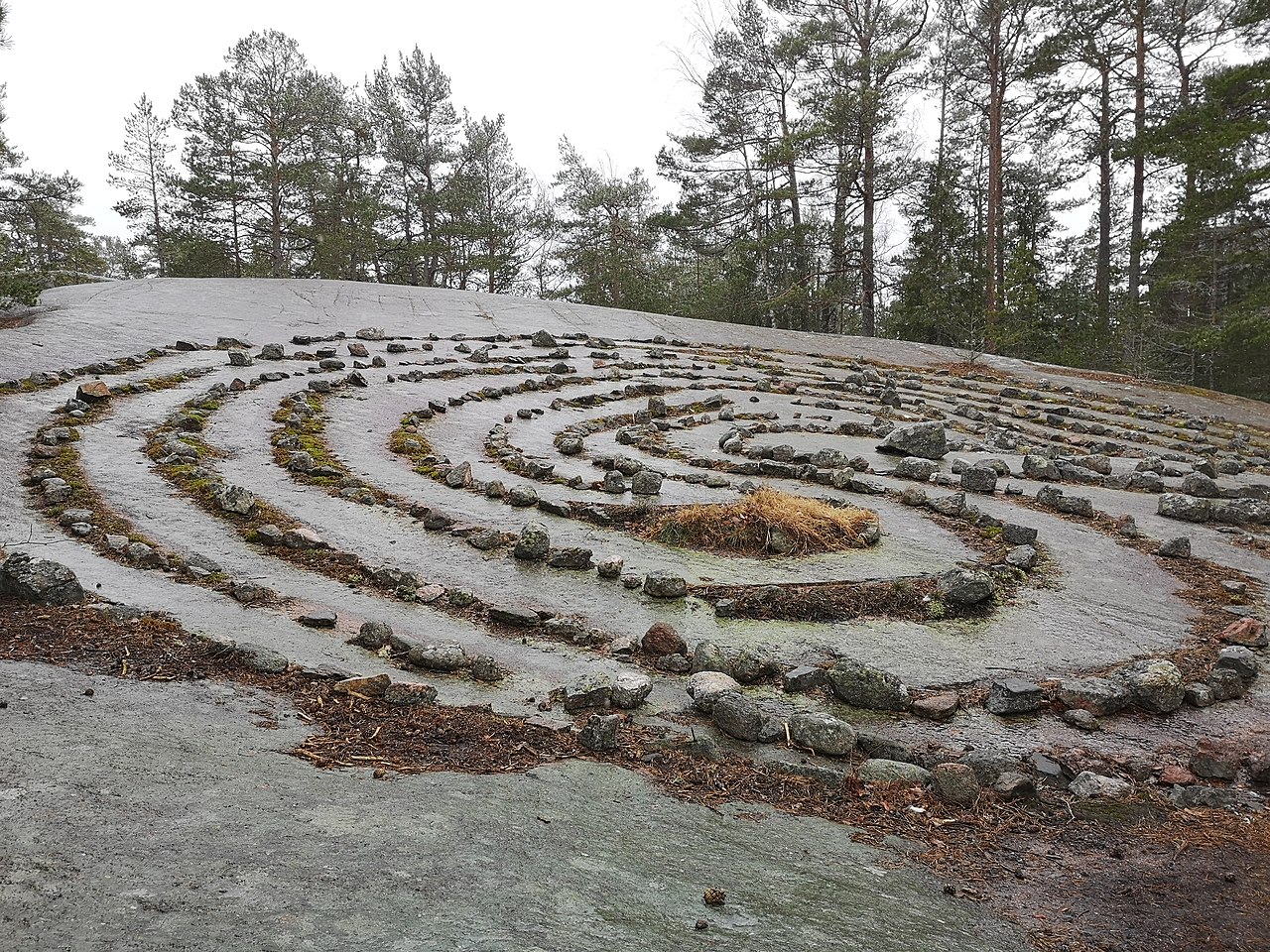
Photo Susannaanas · CC BY-SA 3.0Source file on Wikimedia Commons

Overview
About this site
What the sources say
Ernholmsberget is a megalithic mound in Pargas, Finland. The catalogue places it at 60.1865° N, 21.9180° E and links it to Wikidata item Q65107140.
Built from structured records, not from an articleSources and licences
Where it sits in time
The site's dated range, placed against world reference points.
The scale is logarithmic: each step to the left is about ten times older than the last.
The full article
About Ernholmsberget
This kind of monument hereSources for this section
- en.wikipedia.orgCC BY-SA 4.0
- en.wikipedia.orgCC BY-SA 4.0
- en.wikipedia.orgCC BY-SA 4.0
- en.wikipedia.orgCC BY-SA 4.0
Sources for this section
- en.wikipedia.orgCC BY-SA 4.0
- en.wikipedia.orgCC BY-SA 4.0
- en.wikipedia.orgCC BY-SA 4.0
- en.wikipedia.orgCC BY-SA 4.0
Finland's prehistoric stone monuments are cairns and boulder enclosures, built by hunter-gatherers and early farmers on ridges that once looked out over the sea. The best-preserved cairn field is Sammallahdenmäki, near Rauma, a UNESCO World Heritage Site since 1999. Thirty-three granite cairns lie in clusters along a long ridge, built from boulders quarried from the cliff below or gathered on the spot. They date from about 1500 to 500 BCE; twenty-eight are early Bronze Age and the rest early Iron Age. Two are unusual: the Huilun pitkä raunio, the "long ruin of Huilu", is ringed by an ancient stone wall, and Kirkonlaattia, "Church Floor", is a rectangular cairn. Many cairns have not been dug, and dating then relies on their shape and on excavated neighbours. Further down this page, About this kind of monument gives the whole of “Finnish Bronze Age cairns and giant's churches”.
DatingSources for this section
- en.wikipedia.orgCC BY-SA 4.0
Sources for this section
- en.wikipedia.orgCC BY-SA 4.0
The Atlas shows 2000 BCE to 500 BCE for this site, but that is a regional estimate for this kind of monument, not a date for this particular megalithic mound. No excavation, radiocarbon sample or other measurement is recorded for it, so the real age could fall anywhere within the range, or outside it.
The range rests on this regional background (source: the Wikipedia article “Nordic Bronze Age”): Finnish burial mounds belong to the Bronze Age of the Nordic sphere (c. 2000-500 BC); the Battle Axe culture flourished in south-west Finland c. 2800-2300 BC.
Landscape and neighbours
Counting outward from Ernholmsberget, there are 0 catalogued sites within 1 km, 9 within 5 km and 39 within 10 km, and 36 of them are also classed as megalithic mound. In Pargas, Finland, 163 of the 176 catalogued sites are classed as megalithic mound.
The nearest neighbours in the catalogue are Hvits (2.7 km north-west, megalith); Dragonängen (3.4 km east, megalithic mound); Tvärbergen (3.6 km east, megalithic mound); Kungen 1 (3.6 km east, megalithic mound). The catalogue is assembled from open records and is not complete, so unrecorded monuments may lie closer.
Records and protectionSources for this section
Sources for this section
Heritage records attach the status registered archaeological site in Finland to this site. The open records for it are Wikidata (Q65107140), where corrections and further identifiers can be added. Many such sites stand on private land; check local access rules and respect the monument and its surroundings.
How this page was madeSources for this section
Sources for this section
This page was built automatically from Wikidata (CC0), the heritage register named above and the regional article “Finnish Bronze Age cairns and giant's churches”, written for the Atlas from the Wikipedia articles it cites (CC BY-SA 4.0), plus distances and counts computed from the catalogue coordinates. It contains no AI-written text.
Tradition and region
About this kind of monument
Finnish Bronze Age cairns and giant's churches
Finland's prehistoric stone monuments are cairns and boulder enclosures, built by hunter-gatherers and early farmers on ridges that once looked out over the sea. The best-preserved cairn field is Sammallahdenmäki, near Rauma, a UNESCO World Heritage Site since 1999. Thirty-three granite cairns lie in clusters along a long ridge, built from boulders quarried from the cliff below or gathered on the spot. They date from about 1500 to 500 BCE; twenty-eight are early Bronze Age and the rest early Iron Age. Two are unusual: the Huilun pitkä raunio, the "long ruin of Huilu", is ringed by an ancient stone wall, and Kirkonlaattia, "Church Floor", is a rectangular cairn. Many cairns have not been dug, and dating then relies on their shape and on excavated neighbours.
An older and different tradition is the "Giant's Churches" (Jätinkirkko) of the Ostrobothnia coast. These are rectangular or oval embankments of boulders, about forty known, spread along a 400-kilometre strip of coast from Kokkola to Kemi. They are dated to the Subneolithic, roughly 3500 to 2000 BCE, and were built by hunter-gatherers; the largest known, Kastelli, encloses an area of 60 by 35 metres. Although they stand inland today, they were probably built on the shore. There is no firm evidence of their purpose; one suggestion is that seal hunters used them on the spring ice.
The name is itself folk tradition: jätinkirkko, "giant's church", is a popular label that says nothing about what the enclosures were really for.
When visiting, walk a cairn field along the ridge and notice how each cairn sits slightly apart, often on the highest ground, and look for the straight sides and rounded corners of a giant's church in the forest.
Paraphrased from Wikipedia: Sammallahdenmäki, Wikipedia: Giant's Churches, Wikipedia: Cairn, Wikipedia: Burial mound · CC BY-SA 4.0
See it in 3D
An interpretive reconstruction of the monument, standing on the real ground at its exact point, under the sun for that place and season. Drag to look around it.
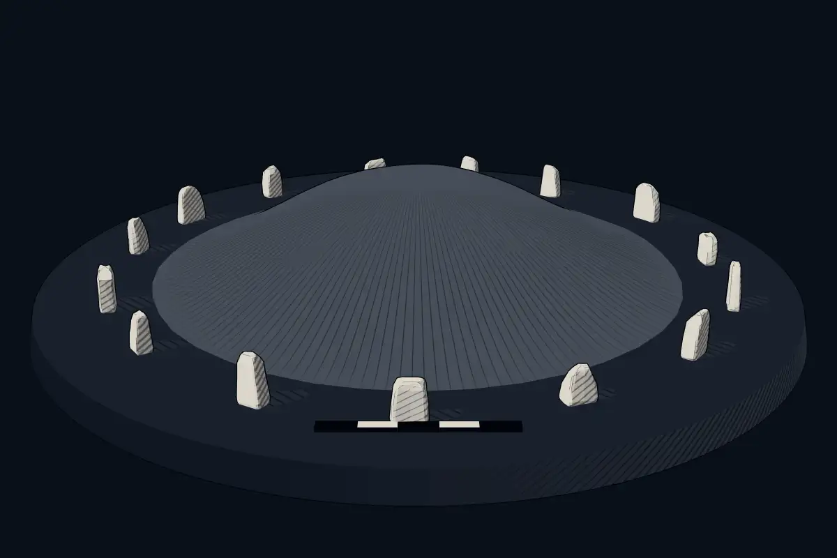
The reconstruction is ours, not a survey: it shows what a monument of this type looks like, at the size the record gives for this one.
Photographs
1 photograph, each with its author and licence
Lore
Evidence & Lore
What the sources actually support — and, kept apart, what has been claimed.
What the evidence supports
Dates
Est. 2000–500 BCEHow this date was established: Type comparisonTypical range for megalithic mounds in Finland; this site has not been dated itself. Finnish burial mounds belong to the Bronze Age of the Nordic sphere (c. 2000-500 BC); the Battle Axe culture flourished in south-west Finland c. 2800-2300 BC.Source for this date
Where it stands
Finland
The pin marks the monument itself — its exact point.
- Coordinates
- 60°11′12″ N, 21°55′05″ EFor a GPS or map app: 60.18654, 21.91800
Access is as our sources describe it; we have not visited the site to check.
Nearby
The closest sites in the Atlas, by straight line.
 Hvits3500–2800 BCE
- Megalithic mound (tumulus with integral stones)Dragonängen2000–500 BCE
- Megalithic mound (tumulus with integral stones)Tvärbergen2000–500 BCE
- Megalithic mound (tumulus with integral stones)Kungen 12000–500 BCE
- Megalithic mound (tumulus with integral stones)Piparby2000–500 BCE
- Megalithic mound (tumulus with integral stones)Kungen 22000–500 BCE
- Megalithic mound (tumulus with integral stones)Taslot2000–500 BCE
- Megalithic mound (tumulus with integral stones)Brännskär2000–500 BCE

Sources
Every record behind this page, with the link it came from.
2 sources behind this page
- 01Wikidata Q65107140wikidata.org
- 02Source for this dateen.wikipedia.org
Image files
- Ernholmsberget.jpgSusannaanasCC BY-SA 3.0
Report a correctionWrong date, name, photograph or source? Tell us and it will be put right.
Around this place
The ten nearest sites, by compass
Credit
Text, licence and sources
This page is assembled from open records (Wikidata, CC0; OpenStreetMap, ODbL) and a tradition article paraphrasing Wikipedia (CC BY-SA 4.0). No article exists for this site, and nothing here is written by a model.
- Wikidata Q65107140CC0
- en.wikipedia.orgCC BY-SA 4.0
- en.wikipedia.orgCC BY-SA 4.0
- en.wikipedia.orgCC BY-SA 4.0
- en.wikipedia.orgCC BY-SA 4.0
- en.wikipedia.orgCC BY-SA 4.0