.jpg/1920px-Burninburu_txabala_1_harrespila_(beste_aldetik).jpg 1920w)
Burninburu txabala 1
DatedEst. 3300–2500 BCE
Photo Asier Iturralde Sarasola · CC BY-SA 4.0Source file on Wikimedia Commons

Overview
About this site
Overview
Burninburu txabala 1 is a stone circle in Arano, Spain. It lies at 43.1837° N, 1.8964° W, at an elevation of 615 m.
Catalogue recordSources and licences
Where it sits in time
The site's dated range, placed against world reference points.
The scale is logarithmic: each step to the left is about ten times older than the last.
Article
Burninburu txabala 1
ContextSources for this section
- en.wikipedia.orgCC BY-SA 4.0
- en.wikipedia.orgCC BY-SA 4.0
- en.wikipedia.orgCC BY-SA 4.0
- en.wikipedia.orgCC BY-SA 4.0
- en.wikipedia.orgCC BY-SA 4.0
Sources for this section
- en.wikipedia.orgCC BY-SA 4.0
- en.wikipedia.orgCC BY-SA 4.0
- en.wikipedia.orgCC BY-SA 4.0
- en.wikipedia.orgCC BY-SA 4.0
- en.wikipedia.orgCC BY-SA 4.0
In French, Spanish and many other languages a cromlech is a stone circle. In the Pyrenees, and especially in the Basque lands, the commonest stone circles are small burial monuments of the Iron Age. About 851 of these funerary cromlechs are documented in the Pyrenean region. Their diameters are 3 to 7 metres, with a burial in the middle, and the dead were not cremated inside the circle but at a nearby place, with only a handful of ashes carried to the monument. Burial customs changed over time, with a clear dominance of cremation in the Iron Age, and the ashes were placed in stone circles, mounds, caves, cists or urn fields. The regional background, “Iberian and French cromlechs”, is given below.
DatingSources for this section
- en.wikipedia.orgCC BY-SA 4.0
Sources for this section
- en.wikipedia.orgCC BY-SA 4.0
No scientific date has been published for this site. Monuments of this type in Spain are generally dated 3300 BCE to 2500 BCE; the site itself may fall inside or outside that range.
Stone circles are typical of north-western Europe and most were built between 3300 and 2500 BC.
Setting
321 other recorded monuments lie within 10 km (40 within 1 km, 119 within 5 km), 228 of them of the same type. The site belongs to a dense concentration of monuments. In Arano, Spain, 54 of the 56 recorded monuments are of this type.
The nearest recorded monuments are Burninburu txabala 2 (0.0 km east, stone circle); Burninburu txabala 3 (0.0 km south-west, stone circle); Burninburu txabala 4 (0.0 km south-east, stone circle); Burninburu txabala 5 (0.0 km south, stone circle).
ProtectionSources for this section
Sources for this section
Heritage status: Archaeological site in Nafarroa.
Tradition and region
About this kind of monument
Iberian and French cromlechs
In French, Spanish and many other languages a cromlech is a stone circle. In the Pyrenees, and especially in the Basque lands, the commonest stone circles are small burial monuments of the Iron Age. About 851 of these funerary cromlechs are documented in the Pyrenean region. Their diameters are 3 to 7 metres, with a burial in the middle, and the dead were not cremated inside the circle but at a nearby place, with only a handful of ashes carried to the monument. Burial customs changed over time, with a clear dominance of cremation in the Iron Age, and the ashes were placed in stone circles, mounds, caves, cists or urn fields.
The Alentejo in Portugal has much older circles. The Almendres Cromlech, near Évora, is the largest group of structured menhirs on the Iberian Peninsula, one of the largest in Europe. About 95 granite monoliths stand in small groups. The older Early Neolithic stones form two or three concentric circles of smaller monoliths in the west, the Middle Neolithic ones form two irregular ellipses with large menhirs, and in the Late Neolithic the earlier work was modified into a site for ritual. Many stones were found where they had fallen and were re-erected by Mário Varela Gomes. The site was rediscovered in 1966.
The dates are very different, from the Neolithic in Portugal to the Iron Age in the Pyrenees, so the single word cromlech hides several traditions.
When visiting, look for the entrance gap or axis of a circle, for the stones' differing heights, and for the position of the monument in relation to the sunrise.
Paraphrased from Wikipedia: Cromlech, Wikipedia: Almendres Cromlech, Wikipedia: Basque prehistory, Wikipedia: Portela de Mogos Cromlech, Wikipedia: Carnac stones · CC BY-SA 4.0
See it in 3D
An interpretive reconstruction of the monument, standing on the real ground at its exact point, under the sun for that place and season. Drag to look around it.
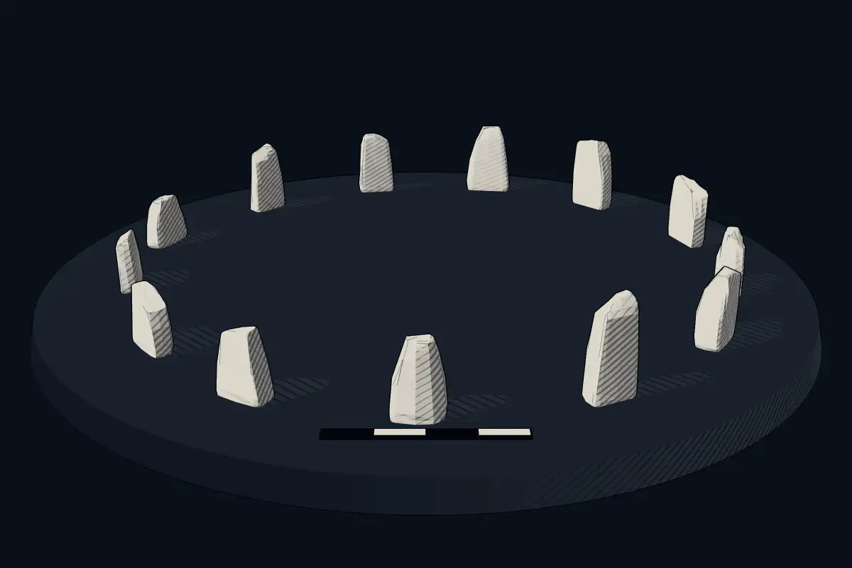
The reconstruction is ours, not a survey: it shows what a monument of this type looks like, at the size the record gives for this one.
Photographs
1 photograph, each with its author and licence
Lore
Evidence & Lore
What the sources actually support — and, kept apart, what has been claimed.
What the evidence supports
Dates
Est. 3300–2500 BCEHow this date was established: Type comparisonTypical range for stone circles in Spain; this site has not been dated itself. Stone circles are typical of north-western Europe and most were built between 3300 and 2500 BC.Source for this date
Where it stands
Spain
The pin marks the monument itself — its exact point.
- Coordinates
- 43°11′01″ N, 1°53′47″ WFor a GPS or map app: 43.18368, -1.89637
Access is as our sources describe it; we have not visited the site to check.
Nearby
The closest sites in the Atlas, by straight line.
- Stone circleBurninburu txabala 23300–2500 BCE
- Stone circleBurninburu txabala 33300–2500 BCE
- Stone circleBurninburu txabala 43300–2500 BCE
- Stone circleBurninburu txabala 53300–2500 BCE
- Stone circleBurninburu txabala 63300–2500 BCE
- Stone circleBurninburu txabala 73300–2500 BCE
 Burninburu soro3300–2500 BCE
 Ezkiturritako gaña 13300–2500 BCE


Sources
Every record behind this page, with the link it came from.
2 sources behind this page
- 01Wikidata Q66112567wikidata.org
- 02Source for this dateen.wikipedia.org
Image files
- Burninburu txabala 1 harrespila (beste aldetik).jpgAsier Iturralde SarasolaCC BY-SA 4.0
Report a correctionWrong date, name, photograph or source? Tell us and it will be put right.
Around this place
The ten nearest sites, by compass
Credit
Text, licence and sources
Compiled from open records (Wikidata, CC0; OpenStreetMap, ODbL) and a regional background article based on Wikipedia (CC BY-SA 4.0).
- Wikidata Q66112567CC0
- en.wikipedia.orgCC BY-SA 4.0
- en.wikipedia.orgCC BY-SA 4.0
- en.wikipedia.orgCC BY-SA 4.0
- en.wikipedia.orgCC BY-SA 4.0
- en.wikipedia.orgCC BY-SA 4.0
- en.wikipedia.orgCC BY-SA 4.0