
MegalithFringe site
Hatnub
Datedc. 2589 BCE–300 CE
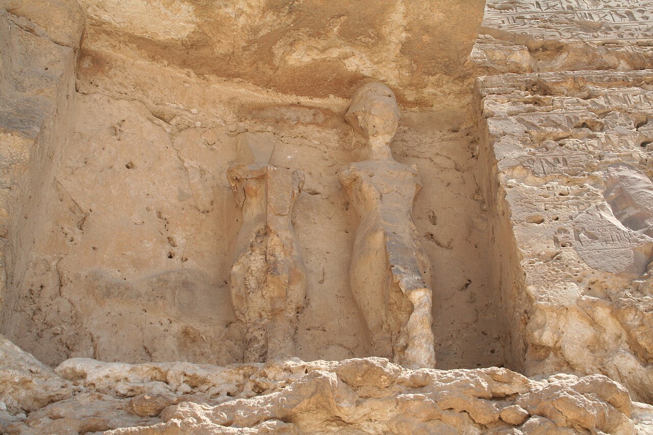
Photo Hannah Pethen · CC BY-SA 2.0Source file on Wikimedia Commons
Overview
About this site
Overview
Hatnub was the location of Egyptian alabaster quarries and an associated seasonally occupied workers' settlement in the Eastern Desert, about 65 km (40 mi) from el-Minya, south-east of el-Amarna.
Pottery, hieroglyph inscriptions and hieratic graffiti show that it was in use intermittently from at least as early as the reign of Khufu until the Roman period (c. 2589 BC-AD 300).
Read on Wikipedia2 min readCC BY-SA 4.0
Where it sits in time
The site's dated range, placed against world reference points.
The scale is logarithmic: each step to the left is about ten times older than the last.
Article
Hatnub
Like the settlements associated with gold mines in the Wadi Hammamat and elsewhere, it is characterised by drystone windbreaks, roads, causeways, cairns and stone alignments.
DescriptionSources for this section
- Wikipedia (English): HatnubCC BY-SA 4.0
Sources for this section
- Wikipedia (English): HatnubCC BY-SA 4.0
The Hatnub quarry settlement is associated with three principal quarries. Like the settlements associated with gold mines in the Wadi Hammamat and elsewhere, it is characterised by drystone windbreaks, roads, causeways, cairns and stone alignments.
Research historySources for this section
- Wikipedia (English): HatnubCC BY-SA 4.0
Sources for this section
- Wikipedia (English): HatnubCC BY-SA 4.0
Hatnub was first described in modern times by Percy Newberry and Howard Carter in 1891. Many inscriptions on the rocks were first described by George Willoughby Fraser and Marcus Worsley Blackden, members of the same expedition. For nearly a hundred years archaeologists concentrated on finding and translating these inscriptions, which illuminated much of ordinary life in ancient Egypt. Only when Ian Shaw and his team began studying the material remains were the two integrated to give a fuller picture.
For example, no New Kingdom inscriptions were found, and it was thought that the quarries were not used during that period. Shaw and his team found New Kingdom pottery fragments showing that workers from this period must have used the quarries.
ArchaeologySources for this section
- Wikipedia (English): HatnubCC BY-SA 4.0
Sources for this section
- Wikipedia (English): HatnubCC BY-SA 4.0
In 2018, researchers from the University of Liverpool's Department of Archaeology, Classics and Egyptology (ACE) and the Institut Français d'Archéologie Orientale (IFAO) announced the discovery of an ancient ramp at the site. The well-preserved ramp dates to the reign of Khufu and may shed light on how his Great Pyramid was constructed. Project co-director Yannis Gourdon of the IFAO describes the system as composed of a central ramp flanked by two staircases with numerous post holes. A sled carrying a stone block was attached with ropes to these wooden posts, which allowed the ancient Egyptians to pull alabaster blocks up out of the quarry on very steep slopes of 20 percent or more.
Tradition and region
About this kind of monument
Pharaonic stone monuments of Egypt
Egypt's stone monuments are the best dated and the most famous in the Atlas. The pyramid took shape from the mastaba, a flat-roofed rectangular tomb with sloping sides built of mudbrick or limestone, which marked the burial sites of eminent Egyptians in the Early Dynastic Period and Old Kingdom. The Great Pyramid of Giza, the tomb of the Fourth Dynasty pharaoh Khufu ("Cheops"), was built about 2600 BCE over a period of about 26 years. It was originally 146.6 metres high and remained the world's tallest human-made structure for more than 3,700 years. Most of the smooth white limestone casing has been removed over time, which has lowered the pyramid's height to the present 138.5 metres.
Temples were just as large. The Karnak Temple Complex near Luxor is a vast mix of temples, pylons, chapels and other buildings. Construction began in the reign of Senusret I (1971 to 1926 BCE) in the Middle Kingdom and continued into the Ptolemaic Kingdom (305 to 30 BCE), though most of the surviving buildings date from the New Kingdom. An obelisk, which the Egyptians called tekhenu, is a tall, four-sided, narrow tapering monument, usually a single block of stone, with a pyramidal top.
Egyptian monuments are dated by the reigns of the kings who built them, and many carry their names. This is a strong contrast with the prehistoric megaliths of Europe, which can be dated only by radiocarbon or by comparison.
The Atlas files these monuments among the megaliths only because they are great works in stone.
When visiting, look at the scale of the blocks and at the inscriptions and reliefs that give the names of the kings.
Paraphrased from Wikipedia: Pyramid, Wikipedia: Great Pyramid of Giza, Wikipedia: Temple of Karnak, Wikipedia: Obelisk, Wikipedia: Mastaba · CC BY-SA 4.0
From the article
Dated moments in the story
- 2589 BCE
The pottery, hieroglyph inscriptions and hieratic graffiti at the site show that it was in use intermittently from at least as early as the reign of Khufu until the Roman period (c. 2589 BC–AD 300).
Source - 1891
Hatnub was first described in modern times by Percy Newberry and Howard Carter in 1891. There are many inscriptions on the rocks, and these were first described by George Willoughby Fraser and Marcus Worsley Blackden, members of this same expedition.
Source - 2018
In 2018, researchers from the University of Liverpool's Department of Archaeology, Classics and Egyptology (ACE) and the Institut Français d'Archéologie Orientale (IFAO) announced the discovery of an ancient ramp at the site.
Source
Photographs
1 photograph, each with its author and licence
Lore
Evidence & Lore
What the sources actually support — and, kept apart, what has been claimed.
What the evidence supports
Dates
2589 BCE–300 CEHow this date was established: Historical sourcesThe date range is based on documented use from the reign of Khufu to the Roman period.Source for this date
Measured facts
- Location
- Eastern Desert of Egypt, about 65 km from el-MinyaSource: Location
- Main activity
- Egyptian alabaster quarryingSource: Main activity
- Principal quarries
- threeSource: Principal quarries
- First modern description
- Percy Newberry and Howard Carter in 1891Source: First modern description
- New Kingdom evidence
- pottery fragments found by Ian Shaw and his teamSource: New Kingdom evidence
- Culture
- Ancient EgyptSource: Culture
Where it stands
Egypt
The pin marks the monument itself — its exact point.
- Coordinates
- 27°33′00″ N, 31°00′00″ EFor a GPS or map app: 27.55000, 31.00000
Access is as our sources describe it; we have not visited the site to check.
Nearby
The closest sites in the Atlas, by straight line.



Sources
Every record behind this page, with the link it came from.
2 sources behind this page
- 01Wikidata Q922009wikidata.org
- 02Fringe claim sourceen.wikipedia.org
Image files
- Hatnub main quarry.jpgHannah PethenCC BY-SA 2.0
Report a correctionWrong date, name, photograph or source? Tell us and it will be put right.
Around this place
The ten nearest sites, by compass
Credit
Text, licence and sources
Adapted from the Wikipedia article "Hatnub" (English), licensed CC BY-SA 4.0; authors are listed in the page history. Reused under CC BY-SA 4.0. Read on Wikipedia · Edit history and authors
- Wikipedia (English): HatnubCC BY-SA 4.0
- Wikidata Q922009CC0