Tved
DatedEst. 1000 BCE–1000 CE
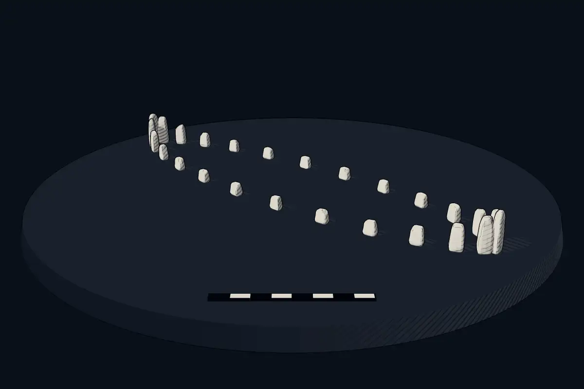
No licensed photograph yetWe have no photograph we may publish for this site, so the interpretive 3D view leads instead.
Overview
About this site
Overview
Tved is a ship setting in Syddjurs Municipality, Denmark. It lies at 56.1832° N, 10.4509° E.
Catalogue recordSources and licences
Where it sits in time
The site's dated range, placed against world reference points.
The scale is logarithmic: each step to the left is about ten times older than the last.
Article
Tved
ContextSources for this section
- en.wikipedia.orgCC BY-SA 4.0
- en.wikipedia.orgCC BY-SA 4.0
- en.wikipedia.orgCC BY-SA 4.0
- en.wikipedia.orgCC BY-SA 4.0
Sources for this section
- en.wikipedia.orgCC BY-SA 4.0
- en.wikipedia.orgCC BY-SA 4.0
- en.wikipedia.orgCC BY-SA 4.0
- en.wikipedia.orgCC BY-SA 4.0
In the Atlas, Denmark has the most stone ship settings. The stone ship, or ship setting, was an early burial custom in Scandinavia, northern Germany and the Baltic states, in which a grave or cremation was surrounded by slabs or stones in the outline of a ship. Ships were erected from about 1000 BCE to 1000 CE, and they are often found in grave fields, though sometimes far from any other remains. The regional background, “Danish stone ship settings”, is given below.
DatingSources for this section
- en.wikipedia.orgCC BY-SA 4.0
Sources for this section
- en.wikipedia.orgCC BY-SA 4.0
No scientific date has been published for this site. Monuments of this type in Denmark are generally dated 1000 BCE to 1000 CE; the site itself may fall inside or outside that range.
The stone ships vary in size and were erected from c. 1000 BCE to 1000 CE.
Setting
81 other recorded monuments lie within 10 km (0 within 1 km, 22 within 5 km). The site belongs to a dense concentration of monuments. In Syddjurs Municipality, Denmark, 1 of the 385 recorded monuments are of this type.
The nearest recorded monuments are Torup Dysse (1.5 km north-east, dolmen); Q30129784 (2.1 km north-east, dolmen); Stenhus (2.1 km east, dolmen); Kannikehøj (2.8 km north-west, megalithic mound).
ProtectionSources for this section
Sources for this section
Heritage status: protected ancient monument in Denmark.
Tradition and region
About this kind of monument
Danish stone ship settings
In the Atlas, Denmark has the most stone ship settings. The stone ship, or ship setting, was an early burial custom in Scandinavia, northern Germany and the Baltic states, in which a grave or cremation was surrounded by slabs or stones in the outline of a ship. Ships were erected from about 1000 BCE to 1000 CE, and they are often found in grave fields, though sometimes far from any other remains.
The most famous Danish ship is at Jelling in Jutland, where the remains of the longest stone ship known lie beneath the two royal barrows. It was formerly thought to have extended between the two mounds and to have been 170 metres long. Re-evaluation of large pits on the west side of the north mound, noted in the 1960s, has led to a different reconstruction in which the ship had the north mound at its centre and was 354 metres long, corresponding to 1,200 Roman feet. King Harald Bluetooth raised a great mound over an existing Bronze Age burial mound, the largest burial mound in Denmark, and placed in it his father Gorm the Old; tree-ring evidence dates the building of the north mound and its new burial chamber to 958 to 959 CE, matching Gorm's death that winter, and the south mound to about 970.
At Lindholm Høje, north of Aalborg, a major Viking burial site, the lower southern part dates to 1000 to 1050 CE and the higher northern part to the fifth century CE. The first major excavation began in 1952 and ultimately included 589 of the approximately 700 graves.
When visiting, look at the large stones at the stem and stern, and at how the ship is laid out in relation to the mounds.
Paraphrased from Wikipedia: Jelling stone ship, Wikipedia: Jelling stones, Wikipedia: Lindholm Høje, Wikipedia: Ship setting · CC BY-SA 4.0
Lore
Evidence & Lore
What the sources actually support — and, kept apart, what has been claimed.
What the evidence supports
Dates
Est. 1000 BCE–1000 CEHow this date was established: Type comparisonTypical range for ship settings in Denmark; this site has not been dated itself. The stone ships vary in size and were erected from c. 1000 BCE to 1000 CE.Source for this date
Where it stands
Denmark
The pin marks the monument itself — its exact point.
- Coordinates
- 56°11′00″ N, 10°27′03″ EFor a GPS or map app: 56.18323, 10.45090
Access is as our sources describe it; we have not visited the site to check.
Nearby
The closest sites in the Atlas, by straight line.
- DolmenTorup Dysse3500–2800 BCE
 Q301297843500–2800 BCE
 Stenhus3500–2800 BCE
- Megalithic mound (tumulus with integral stones)Kannikehøj3500–500 BCE
- Megalithic mound (tumulus with integral stones)Trehøj3500–500 BCE
- Megalithic mound (tumulus with integral stones)Bremhøj3500–500 BCE
- Megalithic mound (tumulus with integral stones)Lindhøj3500–500 BCE
- Megalithic mound (tumulus with integral stones)Brunhøj3500–500 BCE


Sources
Every record behind this page, with the link it came from.
2 sources behind this page
- 01Wikidata Q30129798wikidata.org
- 02Source for this dateen.wikipedia.org
Report a correctionWrong date, name, photograph or source? Tell us and it will be put right.
Around this place
The ten nearest sites, by compass
Credit
Text, licence and sources
Compiled from open records (Wikidata, CC0; OpenStreetMap, ODbL) and a regional background article based on Wikipedia (CC BY-SA 4.0).
- Wikidata Q30129798CC0
- en.wikipedia.orgCC BY-SA 4.0
- en.wikipedia.orgCC BY-SA 4.0
- en.wikipedia.orgCC BY-SA 4.0
- en.wikipedia.orgCC BY-SA 4.0
- en.wikipedia.orgCC BY-SA 4.0