
Thoreby Bysmarker
DatedEst. 3500–2800 BCE
Photo Praeceptor · CC BY-SA 3.0Source file on Wikimedia Commons
Overview
About this site
What the sources say
Der Runddysse von Toreby (auch Thoreby Bysmarker genannt) liegt in einem Feld östlich von Toreby und Maribo in der Guldborgsund Kommune auf der dänischen Insel Lolland.
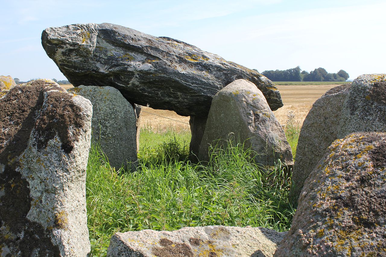
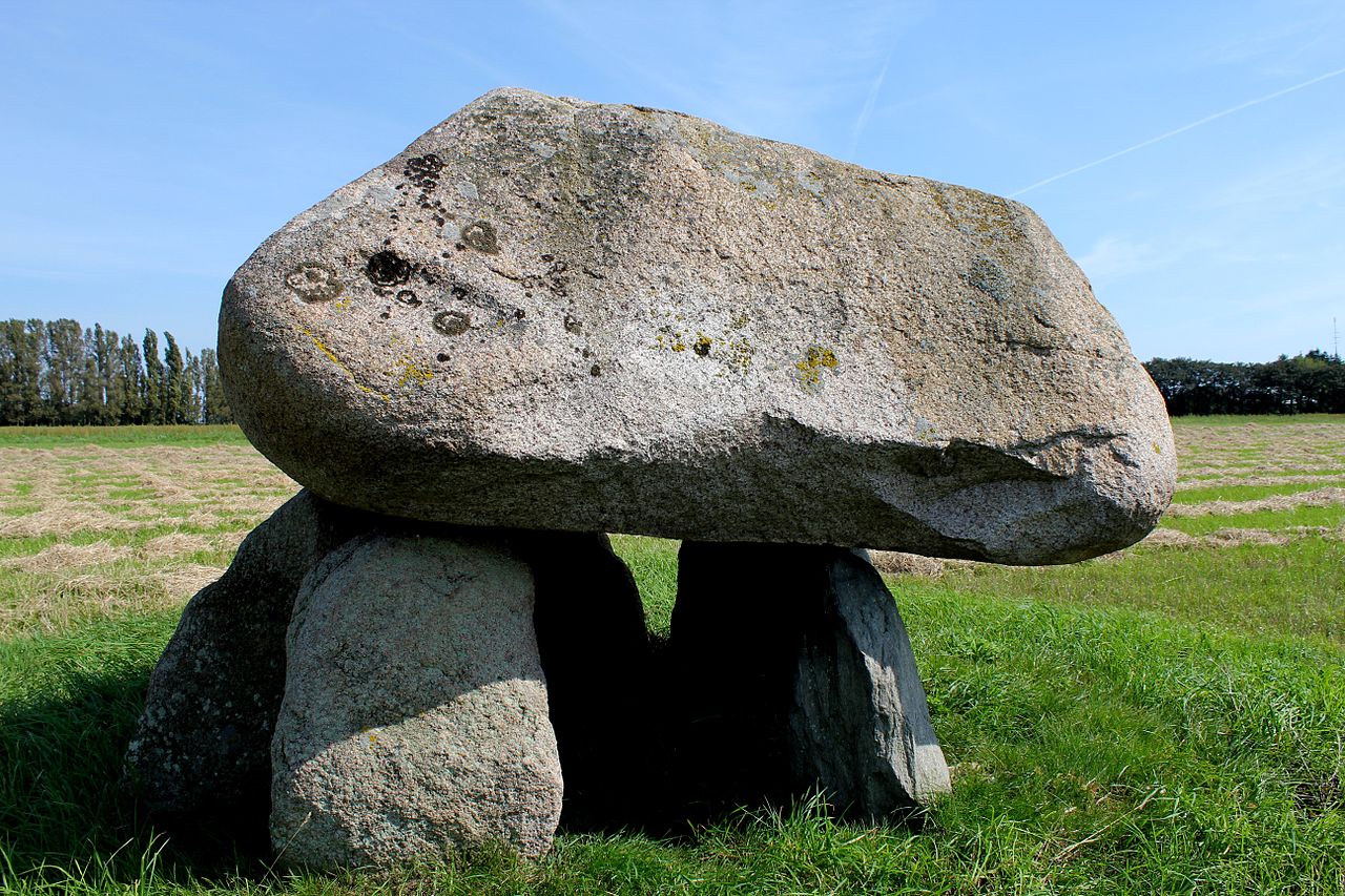
Die ovale Nordost-Südwest orientierte Kammer des beschädigten Ganggrabes besteht aus acht Tragsteinen, von denen sechs original sind und zwei in den 1940er Jahren ergänzt wurden. Farbe und Form trennen die beiden von den übrigen, die mit der flachen Seite zur Kammermitte weisen. Zwei große Decksteine liegen auf. Die Innenmaße betragen etwa 3,0 m in der Länge und 1,25–1,50 m in der Breite. Die Oberkante der Decksteine liegt etwa 2,5 m über der Feldoberfläche Der Gang lag wahrscheinlich im Süden. Im Süden und Osten gibt es Lücken zwischen den Tragsteinen. In der Kammer liegt Geröll.
In der Nähe liegen der Dolmen im Frostrup Skov und der Toreby Barneshøj.
Article in GermanRead on Wikipedia3 min readCC BY-SA 4.0
Where it sits in time
The site's dated range, placed against world reference points.
The scale is logarithmic: each step to the left is about ten times older than the last.
The full article
Thoreby Bysmarker: the whole story
In briefSources for this section
- Wikipedia (German): Runddysse von TorebyCC BY-SA 4.0
Sources for this section
- Wikipedia (German): Runddysse von TorebyCC BY-SA 4.0
Thoreby Bysmarker, also called Runddysse von Toreby, is a dolmen in a field east of Toreby and Maribo, in Guldborgsund Kommune on the Danish island of Lolland. The damaged passage grave has an oval chamber aligned northeast–southwest. Its entrance passage was probably to the south, where gaps remain between the supporting stones.
The chamber is built from eight supporting stones, six original and two added in the 1940s. The two later stones differ in color and form from the others and point with their flat sides toward the center of the chamber. Two large capstones remain on top. Inside, the chamber measures about 3.0 m long and 1.25–1.50 m wide, while the upper edge of the capstones stands about 2.5 m above the field surface.
Thoreby Bysmarker is dated by typological estimate to 3500 BCE to 2800 BCE. Dolmens in Denmark belong to the Funnel Beaker culture of the fourth millennium BCE and are one of two main forms of megalithic tomb, alongside larger passage graves with a long passage leading into a chamber. The site has not been investigated further in the available material.
Nearby monuments include the dolmen in Frostrup Skov and Toreby Barneshøj. Danish megalithic tombs are generally classified under broad terms such as dolmens, passage graves and stone cists, rather than the numerous subtypes used in the German tradition.
No English Wikipedia article exists for it; the full text below is the German article "Runddysse von Toreby", shown in the original language.
Summary in EnglishSources for this section
- Wikipedia (German): Runddysse von TorebyCC BY-SA 4.0
Sources for this section
- Wikipedia (German): Runddysse von TorebyCC BY-SA 4.0
Thoreby Bysmarker is a dolmen in Guldborgsund Municipality, Denmark. Wikidata describes it as: ancient monument in Denmark (4346). A typological estimate: 3500 BCE to 2800 BCE. No English Wikipedia article exists for it; the full text below is the German article "Runddysse von Toreby", shown in the original language.
How this page was madeSources for this section
- Wikipedia (German): Runddysse von TorebyCC BY-SA 4.0
Sources for this section
- Wikipedia (German): Runddysse von TorebyCC BY-SA 4.0
The summary at the top of this page was written by MiniMax-M3 (2026-11-08) from the cited Wikipedia article “Runddysse von Toreby”, translated from German. The numbers in it were checked automatically against the source text. The rest of the page is the article itself, the structured records and computed distances.
Tradition and region
About this kind of monument
Danish dolmens and passage graves (dysser and jættestuer)
Denmark's megalithic tombs belong to the Funnel Beaker culture of the fourth millennium BCE. They fall into two main kinds, dolmens (dysser) and the larger passage graves, with a long passage leading into a chamber. Nordic megalith architecture, the style found especially in Scandinavia and northern Germany, emerged mainly between 3500 and 2800 BCE. In Scandinavia the sites are classed under general terms such as dolmens, passage graves and stone cists, in contrast with the many subtypes of the German tradition.
The great passage graves show how large these tombs could be. Kong Svends Høj on the island of Lolland is a large rectangular mound surrounded by kerbstones about 1.5 metres high, among the tallest recorded in a Neolithic tomb, and covers a chamber 12.5 metres long; the gable stones are almost 4 metres high. Excavation was first attempted there in 1780. Kong Asgers Høj on Møn has a chamber 10 metres long and 2 metres wide with a passage 7.5 metres long, and it was reused for secondary burial in the Corded Ware period. In 1839 the merchant Gustav Hage opened it hoping for treasure and found it empty.
Folklore: the king's names given to these graves come from later tradition and have nothing to do with the Neolithic builders. They show how people over the centuries explained monuments they could not date.
Dating combines radiocarbon dates on bone and charcoal in the chambers, pottery and the architecture. Many dolmens have lost their mounds, leaving the stone skeleton.
When visiting, look for the kerbstones around the base, the capstone and its supports, and the passage entrance.
Paraphrased from Wikipedia: Nordic megalith architecture, Wikipedia: Funnel beaker culture, Wikipedia: Kong Svends Høj, Wikipedia: Kong Asgers Høj, Wikipedia: Dolmen · CC BY-SA 4.0
See it in 3D
An interpretive reconstruction of the monument, standing on the real ground at its exact point, under the sun for that place and season. Drag to look around it.
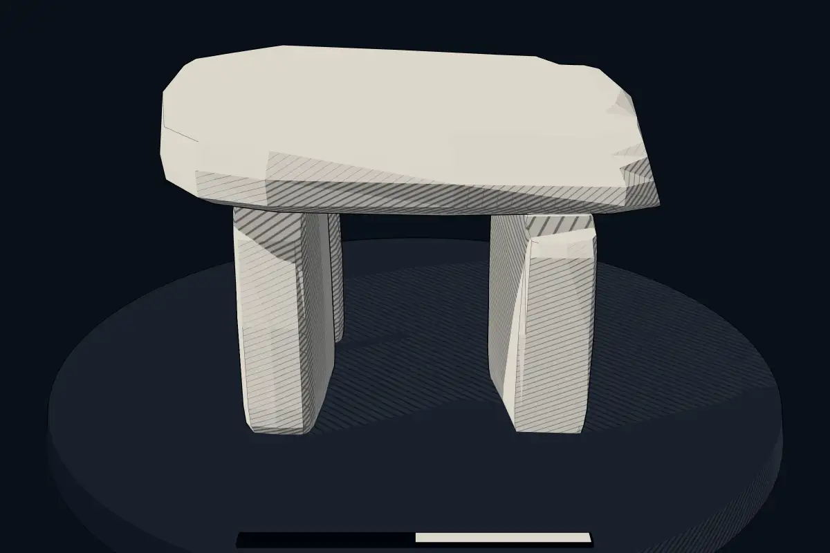
The reconstruction is ours, not a survey: it shows what a monument of this type looks like, at the size the record gives for this one.
Photographs
4 photographs, each with its author and licence
More photographs
Lore
Evidence & Lore
What the sources actually support — and, kept apart, what has been claimed.
What the evidence supports
Dates
Est. 3500–2800 BCEHow this date was established: Type comparisonTypical range for dolmens in Denmark; this site has not been dated itself. Danish dolmens (dysser) belong to the Nordic megalith tradition which emerged predominantly between 3500 and 2800 BC.Source for this date
Where it stands
Denmark
The pin marks the monument itself — its exact point.
- Coordinates
- 54°45′16″ N, 11°47′51″ EFor a GPS or map app: 54.75439, 11.79757
Access is as our sources describe it; we have not visited the site to check.
Nearby
The closest sites in the Atlas, by straight line.




Sources
Every record behind this page, with the link it came from.
2 sources behind this page
- 01Wikidata Q28149368wikidata.org
- 02Source for this dateen.wikipedia.org
Image files
- Thoreby Bysmarker-2.jpgPraeceptorCC BY-SA 3.0
- Thoreby Bysmarker-1.jpgPraeceptorCC BY-SA 3.0
- Thoreby Bysmarker-3.jpgPraeceptorCC BY-SA 3.0
- Thoreby Bysmarker-4.jpgPraeceptorCC BY-SA 3.0
Report a correctionWrong date, name, photograph or source? Tell us and it will be put right.
Around this place
The ten nearest sites, by compass
Credit
Text, licence and sources
Text from the Wikipedia article "Runddysse von Toreby" (German), licensed CC BY-SA 4.0; authors are listed in the page history. Reused under CC BY-SA 4.0. Read on Wikipedia · Edit history and authors
- Wikipedia (German): Runddysse von TorebyCC BY-SA 4.0
- Wikidata Q28149368CC0