Megalithic long barrowThe Copper Age
Pæregård
DatedEst. 3500–2800 BCE
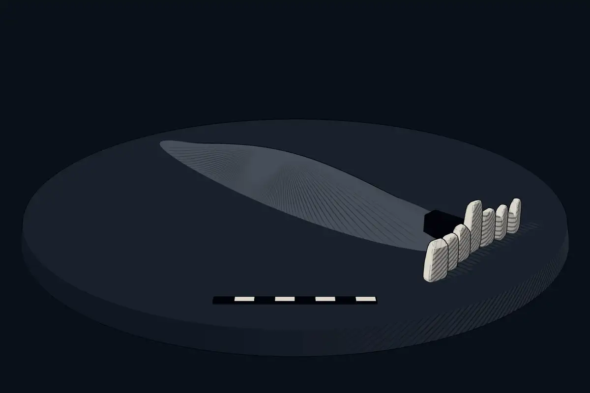
No licensed photograph yetWe have no photograph we may publish for this site, so the interpretive 3D view leads instead.
Overview
About this site
Overview
Pæregård is a group of dolmens and burial mounds on the farm of the same name south-west of Tranekær, on the Danish island of Langeland. The dolmens date to the Neolithic, about 3500–2800 BCE, and are megalithic monuments of the Funnel Beaker culture.
The principal monument is a long barrow (langdysse) on a field at the western steep coast, containing three transverse rectangular dolmens.
Read on Wikipedia3 min readCC BY-SA 4.0
Where it sits in time
The site's dated range, placed against world reference points.
The scale is logarithmic: each step to the left is about ten times older than the last.
Article
Pæregård
At about one metre in height they are unusually large for Danish megalithic monuments in long barrows, especially as they are larger still at the ends of the mound.
DescriptionSources for this section
- Wikipedia (German): PæregårdCC BY-SA 4.0
Sources for this section
- Wikipedia (German): PæregårdCC BY-SA 4.0
The long barrow (Hünenbett) of the three transverse rectangular dolmens measures about 36.0 × 8.0 m and is oriented NNE-SSW. Of the original kerbstones, 45 survive, about half the original number. All stand with their flat side outwards. At about one metre in height they are unusually large for Danish megalithic monuments in long barrows, especially as they are larger still at the ends of the mound.
The three transverse chambers, all with a passage to the east, lie in the southern part of the barrow. They are somewhat disturbed and have no capstones. The south chamber, built of five supporting stones, measures about 2.0 × 1.0 m, and a large threshold stone lies in the entrance; of the passage only a pair of supporting stones remains. The middle chamber is almost completely destroyed, with only the threshold stone and two passage stones preserved. The north chamber is slightly larger than 2.0 × 1.0 m and consists of five supporting stones with well-preserved dry-stone walling between them, a threshold stone in the entrance and a pair of passage stones.
ExcavationsSources for this section
- Wikipedia (German): PæregårdCC BY-SA 4.0
Sources for this section
- Wikipedia (German): PæregårdCC BY-SA 4.0
The chambers were excavated in 1951. They yielded skeletal remains, broken clay vessels and objects of amber, flint and bone from the Neolithic. In the north chamber lay the skeleton of a young woman, probably from the Dagger period. In front of the passage openings a layer of sherds was found, probably resulting from clay vessels having been placed as offerings on the kerbstones.
SettingSources for this section
- Wikipedia (German): PæregårdCC BY-SA 4.0
Sources for this section
- Wikipedia (German): PæregårdCC BY-SA 4.0
About 900 m away, at the southern edge of the wood, three burial mounds lie on both sides of the road. The westernmost was a long barrow with a dolmen, known only to have been destroyed in the nineteenth century; a rise at the edge of the wood with a single large kerbstone remains. Farther east lies a destroyed mound whose age and type are uncertain. Directly beside the forest track lies a decayed dolmen in a round mound with a completely destroyed chamber. None of these three mounds has been investigated. Nearby are Ringelhøj in Snavewald (a disturbed long barrow), the megalithic monuments at Ravnebjerg Skov and the long barrows of Frellesvig.
Tradition and region
About this kind of monument
Northern European long barrows (langdysser)
Further north, the long barrow tradition took its own form. In Denmark and southern Sweden the long barrows typically used stone in their construction, and in the Netherlands and northern Germany they also used stone where it was available. The long barrows in parts of Poland are typically earthen rather than megalithic. They belong to the Funnel Beaker culture, and the architecture of Scandinavia and northern Germany, called Nordic megalith architecture, appeared mainly between 3500 and 2800 BCE.
In Mecklenburg-Vorpommern many dolmens lie inside a trapezoid frame of standing stones that the Germans call a Hünenbett, "giants' bed". Excavators there recognise the "unchambered long barrow" as a type of its own, along with simple dolmens, extended dolmens, passage graves and stone cists.
The purpose of early Neolithic long barrows is not known, though archaeologists can make suggestions based on recurring patterns. One argument is that they were religious sites, perhaps erected as part of a system of ancestor veneration; an alternative is that they were primarily economic or territorial markers.
Folklore: the German name Hünenbett, "giants' bed", reflects the old belief that giants lay in such graves. The barrows were in fact built by Neolithic farmers.
Dating relies on pottery and on radiocarbon dates from the few that have been excavated.
When visiting, look for the long outline of the mound, any kerbstones, and the chambers within it.
Paraphrased from Wikipedia: Long barrow, Wikipedia: Nordic megalith architecture, Wikipedia: Megaliths in Mecklenburg-Vorpommern, Wikipedia: Funnel beaker culture · CC BY-SA 4.0
From the article
Dated moments in the story
- 2800 BCE
Die Dolmen stammen aus der Jungsteinzeit etwa 3500–2800 v. Chr. und sind Megalithanlagen der Trichterbecherkultur (TBK).
Source - 1951
In den 1951 ausgegrabenen Kammern fand man Skelettteile und zerscherbte Tongefäße sowie Gegenstände aus Bernstein, Feuerstein und Knochen, aus der Jungsteinzeit.
Source
Lore
Evidence & Lore
What the sources actually support — and, kept apart, what has been claimed.
What the evidence supports
Dates
Est. 3500–2800 BCEHow this date was established: Type comparisonTypical range for megalithic long barrows in Denmark; this site has not been dated itself. Danish long barrows (langhoje) belong to the Nordic megalith tradition which emerged predominantly between 3500 and 2800 BC.Source for this date
Where it stands
Denmark
The pin marks the monument itself — its exact point.
- Coordinates
- 54°59′21″ N, 10°48′03″ EFor a GPS or map app: 54.98923, 10.80079
Access is as our sources describe it; we have not visited the site to check.
Nearby
The closest sites in the Atlas, by straight line.
- Megalithic long barrowLong barrow, stone age3500–2800 BCE
 Kong Renes Høj3500–2800 BCE
- Megalithic long barrowRindels Høj3500–2800 BCE
- Megalithic mound (tumulus with integral stones)Møllehøj3500–500 BCE
 Kong Holms Høj3500–2800 BCE
- Megalithic mound (tumulus with integral stones)Aasø Skov3500–500 BCE
- Megalithic mound (tumulus with integral stones)Tranekær3500–500 BCE
- Megalithic mound (tumulus with integral stones)Tranekær3500–500 BCE


Sources
Every record behind this page, with the link it came from.
2 sources behind this page
- 01Wikidata Q1701418wikidata.org
- 02Source for this dateen.wikipedia.org
Report a correctionWrong date, name, photograph or source? Tell us and it will be put right.
Around this place
The ten nearest sites, by compass
Credit
Text, licence and sources
Adapted from the Wikipedia article "Pæregård" (German), licensed CC BY-SA 4.0; authors are listed in the page history. Reused under CC BY-SA 4.0. Read on Wikipedia · Edit history and authors
- Wikipedia (German): PæregårdCC BY-SA 4.0
- Wikidata Q1701418CC0