

Overview
About this site
What the sources say
Kámen tisíciletí is a menhir in Zdice, Czech Republic. Its entries are Wikidata item Q66564939; the position in the catalogue is 49.9331° N, 13.9833° E.
Built from structured records, not from an articleSources and licences
Where it sits in time
The site's dated range, placed against world reference points.
The scale is logarithmic: each step to the left is about ten times older than the last.
The full article
About Kámen tisíciletí
This kind of monument hereSources for this section
- en.wikipedia.orgCC BY-SA 4.0
- en.wikipedia.orgCC BY-SA 4.0
- en.wikipedia.orgCC BY-SA 4.0
Sources for this section
- en.wikipedia.orgCC BY-SA 4.0
- en.wikipedia.orgCC BY-SA 4.0
- en.wikipedia.orgCC BY-SA 4.0
Outside the Atlantic fringe, menhirs also occur across central and southern Europe. In the Czech Republic there are about 40 real menhirs and dozens of stones that could also be menhirs, and others have been erected recently. The largest real menhir is Kamenný pastýř, the "stony shepherd", near Klobuky, 3.3 metres high; the Czech menhirs are probably the last outcrop of a tradition that ran across northern Germany. Some of the Czech stones in the Atlas may be natural boulders. The full article, “Central and southern European menhirs”, follows below under About this kind of monument.
DatingSources for this section
- en.wikipedia.orgCC BY-SA 4.0
Sources for this section
- en.wikipedia.orgCC BY-SA 4.0
Typological estimate, not a date for this site: monuments of this kind in this region are normally dated 2800 BCE to 1800 BCE. The range comes from what is known about menhir monuments in Czech Republic; nothing measured on this site itself is on record, so it may be younger or older than the range suggests.
The range rests on this regional background (source: the Wikipedia article “Menhir”): Standing stones of the European late Neolithic and early Bronze Age c. 2800-1800 BC; many Czech menhirs are however medieval stone markers so this is a weak estimate.
Landscape and neighbours
The catalogue lists 0 other sites within 1 km, 1 within 5 km and 1 within 10 km; 1 of them is also classed as menhir. It is one of 1 menhir records among the 1 sites catalogued in Zdice, Czech Republic.
Nearest to it are Menhir u cesty z Hudlic do Lísku (3.8 km north, menhir); Smírčí kámen (Bratronice) (14.9 km north, menhir); Zkamenělec (19.5 km north, menhir); Kámen u silnice do Malé Bukové v Bukové u Příbramě (19.9 km south, menhir). The catalogue is assembled from open records and is not complete, so unrecorded monuments may lie closer.
Records and protectionSources for this section
Sources for this section
The open records used here carry no heritage designation for the site, which says nothing either way about its legal status. The open records for it are Wikidata (Q66564939), where corrections and further identifiers can be added. Access varies from open common land to private fields; check local access rules, ask where needed, and take care not to damage the monument.
How this page was madeSources for this section
Sources for this section
This page was built automatically from Wikidata (CC0) and the regional article “Central and southern European menhirs”, written for the Atlas from the Wikipedia articles it cites (CC BY-SA 4.0), plus distances and counts computed from the catalogue coordinates. It contains no AI-written text.
Tradition and region
About this kind of monument
Central and southern European menhirs
Outside the Atlantic fringe, menhirs also occur across central and southern Europe. In the Czech Republic there are about 40 real menhirs and dozens of stones that could also be menhirs, and others have been erected recently. The largest real menhir is Kamenný pastýř, the "stony shepherd", near Klobuky, 3.3 metres high; the Czech menhirs are probably the last outcrop of a tradition that ran across northern Germany. Some of the Czech stones in the Atlas may be natural boulders.
Italy has its most famous menhirs in Sardinia, where at least 332 standing stones can be seen. They include elaborate "statue-menhirs" that show a human face at the top and gendered symbols on the flat front; over a hundred of this standardised type have been found, mostly around the village of Laconi. In the Sardinian language they are called perdas fittas or perdas lungas. In Switzerland, in the canton of Vaud, several menhirs form linear patterns at Clendy in Yverdon-les-Bains, and date back to the third millennium BCE.
A statue menhir is a carved standing stone of the later European Neolithic, in which a slab or pillar has a stylised human figure cut into it, sometimes with hints of clothing or weapons. They are most commonly found in southern and western France, Catalonia, Corsica, Sardinia, Italy and the Alps.
Menhirs are usually difficult to date, and those without excavation can only be given a broad range. A stone's present position is not always its original one.
When visiting, check whether a stone stands in its original position and look for signs of shaping.
Paraphrased from Wikipedia: Menhir, Wikipedia: List of menhirs, Wikipedia: Statue menhir · CC BY-SA 4.0
See it in 3D
An interpretive reconstruction of the monument, standing on the real ground at its exact point, under the sun for that place and season. Drag to look around it.
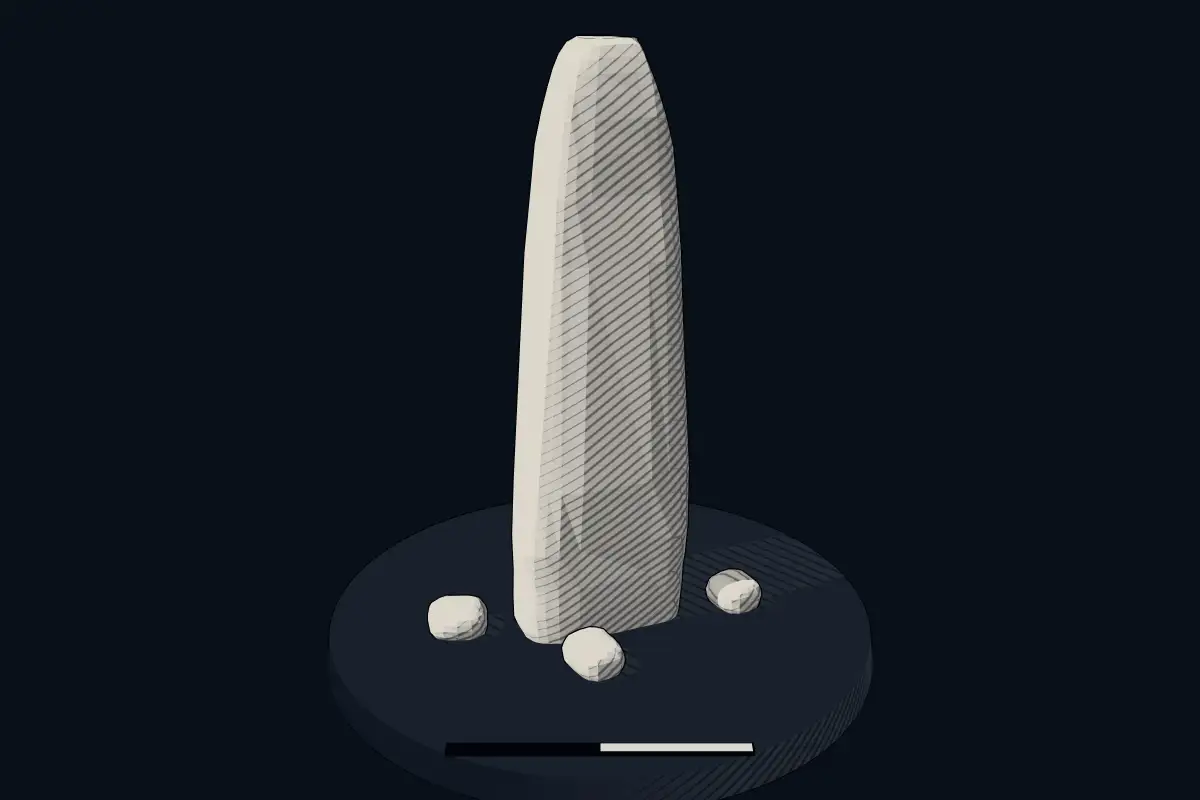
The reconstruction is ours, not a survey: it shows what a monument of this type looks like, at the size the record gives for this one.
Photographs
2 photographs, each with its author and licence
More photographs

Lore
Evidence & Lore
What the sources actually support — and, kept apart, what has been claimed.
What the evidence supports
Dates
Est. 2800–1800 BCEHow this date was established: Type comparisonTypical range for menhirs in Czech Republic; this site has not been dated itself. Standing stones of the European late Neolithic and early Bronze Age c. 2800-1800 BC; many Czech menhirs are however medieval stone markers so this is a weak estimate.Source for this date
Where it stands
Czech Republic
The pin marks the monument itself — its exact point.
- Coordinates
- 49°55′59″ N, 13°59′00″ EFor a GPS or map app: 49.93308, 13.98335
Access is as our sources describe it; we have not visited the site to check.
Nearby
The closest sites in the Atlas, by straight line.
 Menhir u cesty z Hudlic do Lísku2800–1800 BCE
 Smírčí kámen (Bratronice)2800–1800 BCE
 Zkamenělec2800–1800 BCE
- Menhir (standing stone)Kámen u silnice do Malé Bukové v Bukové u Příbramě2800–1800 BCE
 kamenný stůl Bel na Krtneni
- Menhir (standing stone)Menhir u kříže na návsi v Bohutíně2800–1800 BCE
 Menhir u Jemníků2800–1800 BCE
 Menhir v Horoměřicích2800–1800 BCE


Sources
Every record behind this page, with the link it came from.
2 sources behind this page
- 01Wikidata Q66564939wikidata.org
- 02Source for this dateen.wikipedia.org
Image files
Report a correctionWrong date, name, photograph or source? Tell us and it will be put right.
Around this place
The ten nearest sites, by compass
- Menhir u cesty z Hudlic do Lísku3.8 km N
- Smírčí kámen (Bratronice)15 km N
- Zkamenělec20 km N
- Kámen u silnice do Malé Bukové v Bukové u Příbramě20 km S
- kamenný stůl Bel na Krtneni25 km NE
- Menhir u kříže na návsi v Bohutíně31 km S
- Menhir u Jemníků32 km N
- Menhir v Horoměřicích34 km NE
- Slánský menhir35 km N
- Novodobý menhir u Kostelce36 km W
Credit
Text, licence and sources
This page is assembled from open records (Wikidata, CC0; OpenStreetMap, ODbL) and a tradition article paraphrasing Wikipedia (CC BY-SA 4.0). No article exists for this site, and nothing here is written by a model.
- Wikidata Q66564939CC0
- en.wikipedia.orgCC BY-SA 4.0
- en.wikipedia.orgCC BY-SA 4.0
- en.wikipedia.orgCC BY-SA 4.0