Köping 54:1
DatedEst. 2000 BCE–800 CE
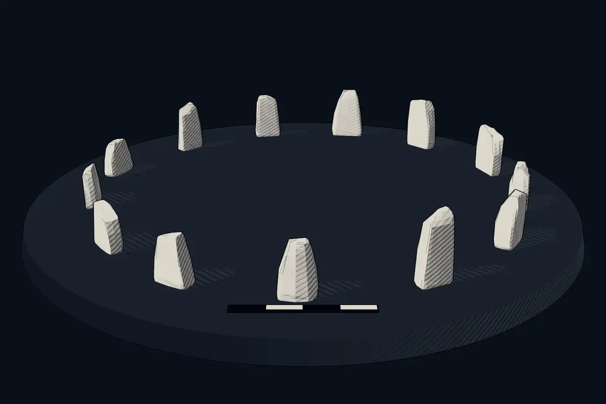
No licensed photograph yetWe have no photograph we may publish for this site, so the interpretive 3D view leads instead.
Overview
About this site
What the sources say
Köping 54:1 is a stone circle recorded in Borgholm Municipality, Sweden. Its entries are Wikidata item Q29406166; the position in the catalogue is 56.8800° N, 16.7239° E.
Built from structured records, not from an articleSources and licences
Where it sits in time
The site's dated range, placed against world reference points.
The scale is logarithmic: each step to the left is about ten times older than the last.
The full article
About Köping 54:1
This kind of monument hereSources for this section
- en.wikipedia.orgCC BY-SA 4.0
- en.wikipedia.orgCC BY-SA 4.0
- en.wikipedia.orgCC BY-SA 4.0
- en.wikipedia.orgCC BY-SA 4.0
Sources for this section
- en.wikipedia.orgCC BY-SA 4.0
- en.wikipedia.orgCC BY-SA 4.0
- en.wikipedia.orgCC BY-SA 4.0
- en.wikipedia.orgCC BY-SA 4.0
Sweden has thousands of recorded stone circles, or round stone settings. Stone circles in southern Scandinavia date mostly to the Iron Age, much later than the great circles of Britain, which were built mostly between 3300 and 2500 BCE. In Scandinavia the stone ship, or ship setting, was an early burial custom, with a grave or cremation surrounded by stones, and ships were built from about 1000 BCE to 1000 CE; round settings belong to the same grave-field tradition, often found alongside ships and mounds. The full article, “Swedish stone circles”, follows below under About this kind of monument.
DatingSources for this section
- en.wikipedia.orgCC BY-SA 4.0
Sources for this section
- en.wikipedia.orgCC BY-SA 4.0
Typological estimate, not a date for this site: monuments of this kind in this region are normally dated 2000 BCE to 800 CE. The range comes from what is known about stone circle monuments in Sweden; nothing measured on this site itself is on record, so it may be younger or older than the range suggests.
The range rests on this regional background (source: the Wikipedia article “Nordic Bronze Age”): Swedish stone circles belong to the Bronze Age of the Nordic sphere (c. 2000-500 BC); during the Iron Age stone circles were built in southern Scandinavia whose Germanic Iron Age ends c. AD 800.
Landscape and neighbours
The catalogue lists 8 other sites within 1 km, 25 within 5 km and 57 within 10 km; 18 of them are also classed as stone circle. That puts it inside a dense cluster of monuments. It is one of 49 stone circle records among the 196 sites catalogued in Borgholm Municipality, Sweden.
The closest catalogued sites are Köping 243:1 (0.0 km south, megalithic mound); Köping 55:2 (0.1 km east, stone circle); Köping 56:1 (0.2 km north-east, megalithic mound); Köping 60:1 (0.3 km east, megalithic mound). The catalogue is assembled from open records and is not complete, so unrecorded monuments may lie closer.
Records and protectionSources for this section
Sources for this section
Wikidata lists the site with the heritage status monument in Fornminnesregistret. The open records for it are Wikidata (Q29406166), where corrections and further identifiers can be added. Sites of this kind often lie on farmland or other private ground, so check local access rules before visiting and leave the monument as you found it.
How this page was madeSources for this section
Sources for this section
Nothing on this page was written by an AI model: it is assembled by program from Wikidata (CC0), the heritage register named above and the regional article “Swedish stone circles”, written for the Atlas from the Wikipedia articles it cites (CC BY-SA 4.0), with distances and counts calculated from the catalogue coordinates.
Tradition and region
About this kind of monument
Swedish stone circles
Sweden has thousands of recorded stone circles, or round stone settings. Stone circles in southern Scandinavia date mostly to the Iron Age, much later than the great circles of Britain, which were built mostly between 3300 and 2500 BCE. In Scandinavia the stone ship, or ship setting, was an early burial custom, with a grave or cremation surrounded by stones, and ships were built from about 1000 BCE to 1000 CE; round settings belong to the same grave-field tradition, often found alongside ships and mounds.
One site shows the variety. Anundshög near Västerås in Västmanland covers about 215 by 205 metres and comprises 42 archaeological remains: 12 burial mounds, 10 round stone settings, 5 stone ships, 14 standing stones and one runestone. The largest mound, also called Anundshög, is 64 to 68 metres across and 9.2 metres high, and charcoal from a hearth at its base was radiocarbon dated to between 210 and 540 CE. Together the stones, mounds and ships show that round stone settings and ship settings stood side by side in the same cemeteries.
Dates are rarely secure. Where a setting has been excavated, its date comes from charcoal and finds, but most are dated only by form and by their neighbours.
When visiting, look for circles in grave fields beside mounds and ship settings, and for the kerb of a collapsed mound.
Paraphrased from Wikipedia: Stone circle, Wikipedia: Ship setting, Wikipedia: Anundshög, Wikipedia: Nordic Bronze Age · CC BY-SA 4.0
See it in 3D
An interpretive reconstruction of the monument, standing on the real ground at its exact point, under the sun for that place and season. Drag to look around it.
The reconstruction is ours, not a survey: it shows what a monument of this type looks like, at the size the record gives for this one.
Lore
Evidence & Lore
What the sources actually support — and, kept apart, what has been claimed.
What the evidence supports
Dates
Est. 2000 BCE–800 CEHow this date was established: Type comparisonTypical range for stone circles in Sweden; this site has not been dated itself. Swedish stone circles belong to the Bronze Age of the Nordic sphere (c. 2000-500 BC); during the Iron Age stone circles were built in southern Scandinavia whose Germanic Iron Age ends c. AD 800.Source for this date
Where it stands
Sweden
The pin marks the monument itself — its exact point.
- Coordinates
- 56°52′48″ N, 16°43′26″ EFor a GPS or map app: 56.88003, 16.72386
Access is as our sources describe it; we have not visited the site to check.
Nearby
The closest sites in the Atlas, by straight line.
- Megalithic mound (tumulus with integral stones)Köping 243:12000 BCE–1050 CE
- Stone circleKöping 55:22000 BCE–800 CE
- Megalithic mound (tumulus with integral stones)Köping 56:12000 BCE–1050 CE
- Megalithic mound (tumulus with integral stones)Köping 60:12000 BCE–1050 CE
- Stone circleKöping 48:32000 BCE–800 CE
- Stone circleKöping 48:22000 BCE–800 CE
- Stone circleKöping 48:12000 BCE–800 CE
- Megalithic mound (tumulus with integral stones)Sote hög el Sothög2000 BCE–1050 CE
Sources
Every record behind this page, with the link it came from.
2 sources behind this page
- 01Wikidata Q29406166wikidata.org
- 02Source for this dateen.wikipedia.org
Report a correctionWrong date, name, photograph or source? Tell us and it will be put right.
Around this place
The ten nearest sites, by compass
Credit
Text, licence and sources
This page is assembled from open records (Wikidata, CC0; OpenStreetMap, ODbL) and a tradition article paraphrasing Wikipedia (CC BY-SA 4.0). No article exists for this site, and nothing here is written by a model.
- Wikidata Q29406166CC0
- en.wikipedia.orgCC BY-SA 4.0
- en.wikipedia.orgCC BY-SA 4.0
- en.wikipedia.orgCC BY-SA 4.0
- en.wikipedia.orgCC BY-SA 4.0